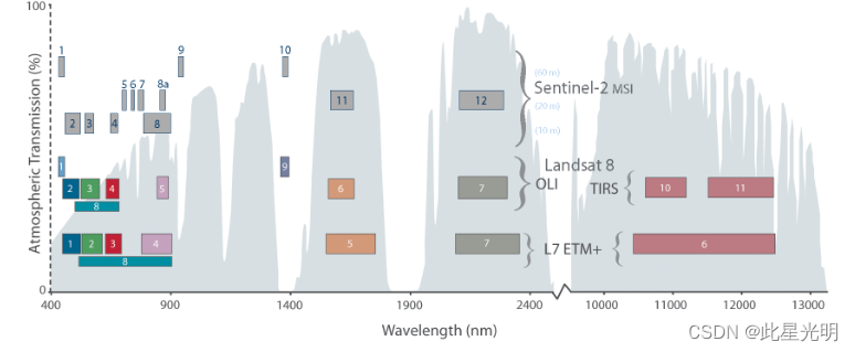
影像集合,具体包含名称、传感器、时间和引用代码
Sensor Dataset.availability Collection.ID
Landsat-4 TM 22/08/1982 - 24/06/1993 LANDSAT/LT04/C02/T1_L2
Landsat-5 TM 16/03/1993 – 05/05/2012 LANDSAT/LT05/C02/T1_L2
Landsat-7 ETM+ 01/01/1999-present LANDSAT/ LC08 /C02/T1_L2
Landsat-8 OLI 11/04/2013- present LANDSAT/LE07/C02/T1_L2
Landsat-9 OLI-2 31/10/2021- present LANDSAT/LC09/C02/T1_L2
Sentinel-2 (MSI) 28/03/2017-present COPERNICUS/S2_SR_HARMONIZED
https://www.cbedai.net/xg
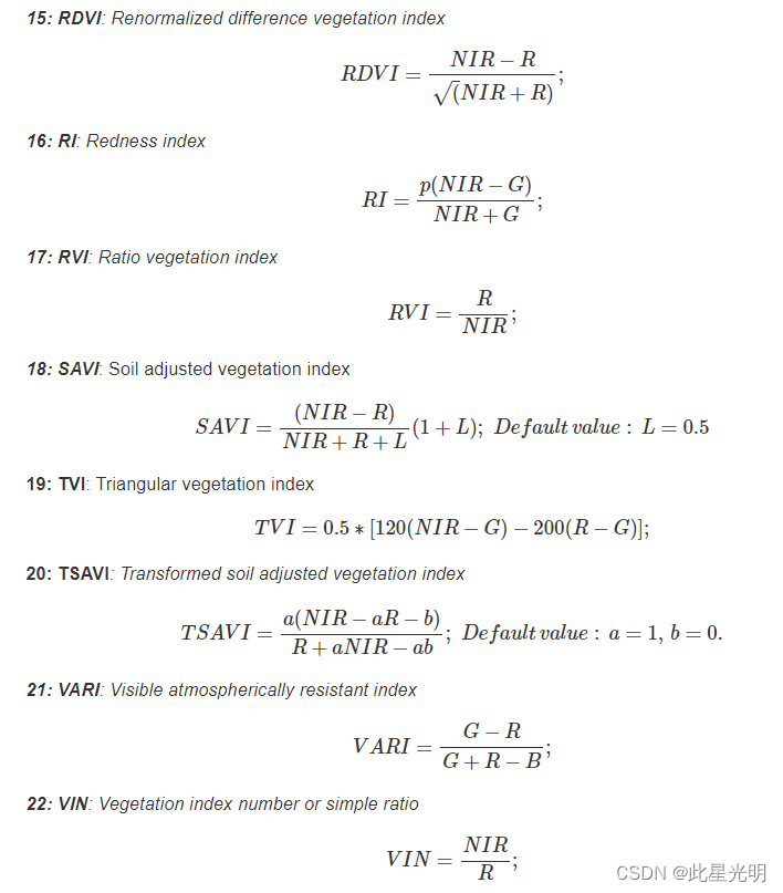
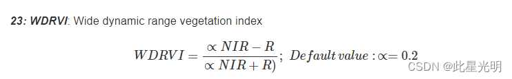
指数:
VIs允许与植被的不同参数或变量发生定量和功能关系。23个VIs,这些VIs通常用于农业应用(Bannari 2009),(Xue 2017)。
这些VIs的名称、它们的数学表达方式以及它们的缩写见以下列表:
1:ARVI:抗大气污染植被指数*。
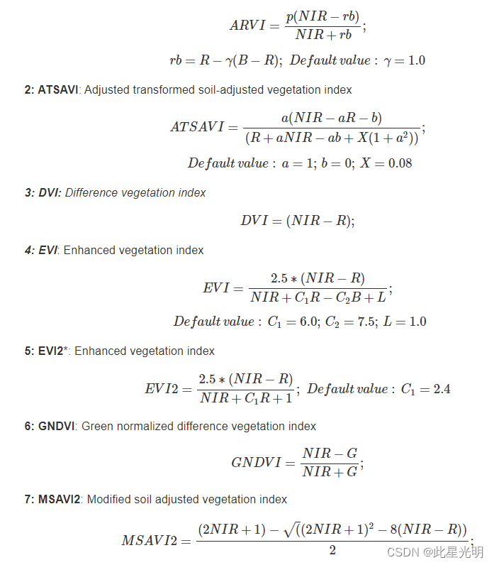

在ARVI、ATSAVI、EVI、EVI2、OSAVI、SAVI、ATSAVI和WDRVI中,即所有那些除了频谱带之外还需要一些调整变量的VI。
在VI方程中使用的光谱带的缩写
Abreviatura Nombre
B Azul/Blue
G Verde/Green
R Rojo/Red
RE Borde Rojo/Red edge
NIR Infrarrojo Cercano /Near infrared
SWIR1 Infrarrojo de onda corta 1/Shortwave infrared 1
SWIR2 Infrarrojo de onda corta 2/Shortwave infrared 2
参考文献:
References
Bannari, Bonn & Huete, Morin. 2009. A Review of Vegetation Indices. Remote Sensing Reviews, 13(1–2), 95–120. https://doi.org/10.1080/02757259509532298.
Xue, Su. 2017. Significant Remote Sensing Vegetation Indices: A Review of Developments and Applications. Journal of Sensors. https://doi.org/10.1155/2017/1353691.