<template>
  <div id="map"></div>
</template>

<script>
import "ol/ol.css";
import {

       Map, View, Feature } from "ol";
import XYZ from "ol/source/XYZ";
import {

       Vector as VectorSource } from "ol/source";
import {

       Vector as VectorLayer, Tile as TileLayer } from "ol/layer";
import {

       Style, Stroke } from "ol/style";
import {

       LineString} from "ol/geom";
export default {


  data() {


    return {


      map: null,
      roadmap: null,
      vectorLayer: null, //创建图层
      vectorSource: null, //图层数据容器
      localtion: [113.5658865038278, 34.82244974031979],
      coordinateGroup: [  //二维数组且必须是number类型
    [
        113.5658865038278,
        34.82244974031979
    ],
    [
        113.56600415226623,
        34.822519711441146
    ],
    [
        113.56610983687841,
        34.82258068399297
    ],
    [
        113.56621651914965,
        34.82264465922389
    ],
    [
        113.56633516621055,
        34.822712628887395
    ],
    [
        113.56644484042172,
        34.82277359939242
    ],
    [
        113.56655152423099,
        34.82283657493385
    ],
    [
        113.56665920551488,
        34.82289854903623
    ],
    [
        113.56676788434261,
        34.82296052274851
    ],
    [
        113.5668546284015,
        34.82301050261998
    ],
    [
        113.56697228186611,
        34.8230794770022
    ],
    [
        113.56707896814156,
        34.82314145363833
    ],
    [
        113.5671866519726,
        34.82320342989416
    ],
    [
        113.56730530424285,
        34.823272404952874
    ],
    [
        113.56741398622616,
        34.82333438133249
    ],
    [
        113.56752366580177,
        34.823396357362526
    ],
    [
        113.56763035478316,
        34.823459337276894
    ],
    [
        113.56773604721097,
        34.823522318418796
    ],
    [
        113.56784174009105,
        34.823584298951744
    ],
    [
        113.56795840171922,
        34.82365327854876
    ],
    [
        113.56806509274989,
        34.82371525920379
    ],
    [
        113.56817178424451,
        34.82377623925931
    ],
    [
        113.56827947340484,
        34.82383822001834
    ],
    [
        113.56838816019234,
        34.82390020045678
    ],
    [
        113.56850582182767,
        34.82396918174404
    ],
    [
        113.56859057844467,
        34.82401816786626
    ],
    [
        113.5686892953319,
        34.82407415094237
    ],
    [
        113.56877405276872,
        34.824125139740325
    ],
    [
        113.56884983613533,
        34.824170129337695
    ],
    [
        113.56891664533839,
        34.82420911965556
    ],
    [
        113.56897846895785,
        34.82424511075731
    ],
    [
        113.56902433827786,
        34.824273105589704
    ],
    [
        113.56906223033695,
        34.824295100209845
    ],
    [
        113.56909015088632,
        34.82431209710039
    ],
    [
        113.5691110912815,
        34.82432409401015
    ],
    [
        113.56912006568128,
        34.82432809150545
    ],
    [
        113.56912106281311,
        34.82432809076629
    ],
    [
        113.56912106275931,
        34.82432708972895
    ],
    [
        113.56912205994502,
        34.82432809002718
    ],
    [
        113.56912305707695,
        34.824328089288116
    ],
    [
        113.56912505139475,
        34.824329088847435
    ],
    [
        113.56912505128714,
        34.824327086772755
    ],
    [
        113.5691210627055,
        34.82432608869162
    ],
    [
        113.56912006551984,
        34.824325088393415
    ],
    [
        113.5691210627055,
        34.82432608869162
    ],
    [
        113.56912205983738,
        34.824326087952514
    ],
    [
        113.56912405415513,
        34.82432708751175
    ],
    [
        113.56912405415513,
        34.82432708751175
    ],
    [
        113.56912305691554,
        34.824325086176096
    ]
]
    }
  },
  methods: {


    initMap() {


      let _self = this;
      //线路图
      this.roadmap = new TileLayer({


        visible: true,
        name: '电子图',
        source: new XYZ({


          url: 服务地址+"/tiles/ZhengZhouShi/roadmap/{z}/{x}/{y}.png",
          crossOrigin: "anonymous", //离线瓦片跨域处理
        }),
      });
      this.map = new Map({


        target: "map",
        layers: [this.roadmap],
        view: new View({


          center: this.localtion,
          projection: "EPSG:4326",
          zoom: 14,
          minZoom: 12,
          maxZoom: 17,
        }),
      });

      // 创建图层
      this.vectorLayer = new VectorLayer();
      // 创建数据容器
      this.vectorSource = new VectorSource();
      // 把数据容器添加到图层
      this.vectorLayer.setSource(this.vectorSource);
      // 添加到地图上
      this.map.addLayer(this.vectorLayer);
      this.flightpath();
    },

    //飞行轨迹
    flightpath() {


      let line = new LineString(this.coordinateGroup);
      let lineFeature = new Feature(line);
      lineFeature.setStyle(
        new Style({


          stroke: new Stroke({


            width: 4,
            color: "#fc1d1d",
          }),
        })
      );
      this.vectorSource.addFeature(lineFeature);
    },
  }
};
</script>

<style scoped lang="scss">
	#map{


		width: 100%;
		height: 800px;
	}
</style>
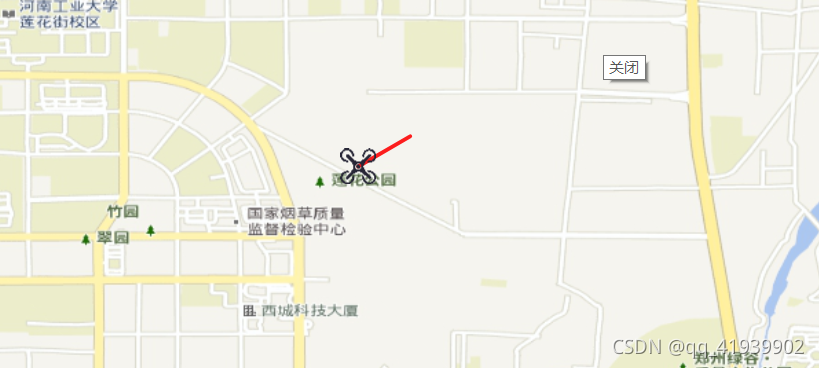
效果图