In recent years, with the acceleration of urbanization and the rapid development of information technology, smart cities have become an important direction of urban development. In the construction of smart cities, the application of geographic information system (GIS) technology is playing an increasingly important role. With its unique geospatial analysis capabilities , GIS technology provides city managers and decision makers with a new perspective, helping city managers and decision makers to better understand the current situation of the city and plan for the future of the city, thereby promoting the city's intelligence and efficiency. development.
The advantages of GIS technology are mainly reflected in the following aspects:
① GIS technology can realize the integration and analysis of geographic data. A city is a complex and huge system that involves all aspects of data and information. GIS technology can integrate geographical data from different sources and conduct comprehensive analysis through spatial analysis methods. Through GIS technology, urban managers can better understand the geographical features and spatial relationships of cities, so as to formulate urban planning and development strategies more scientifically.
Mountain Sea Whale visualization large screen
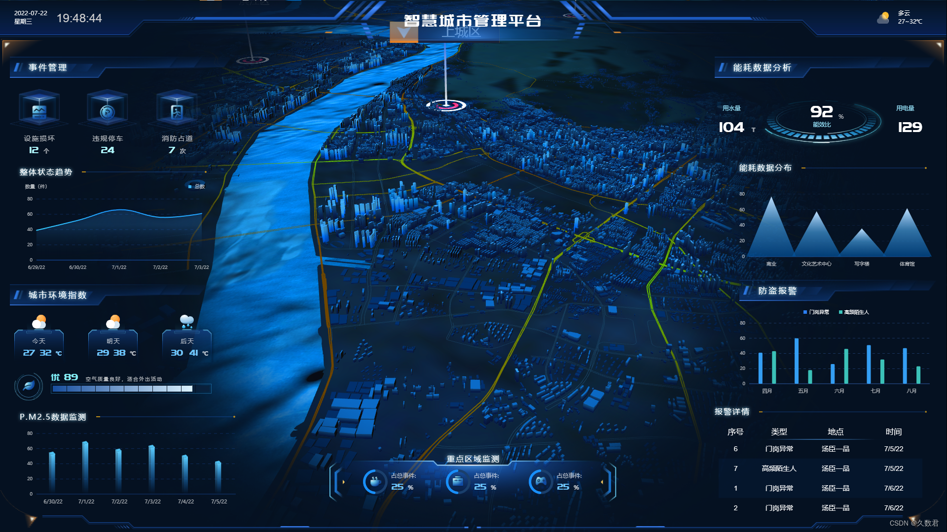
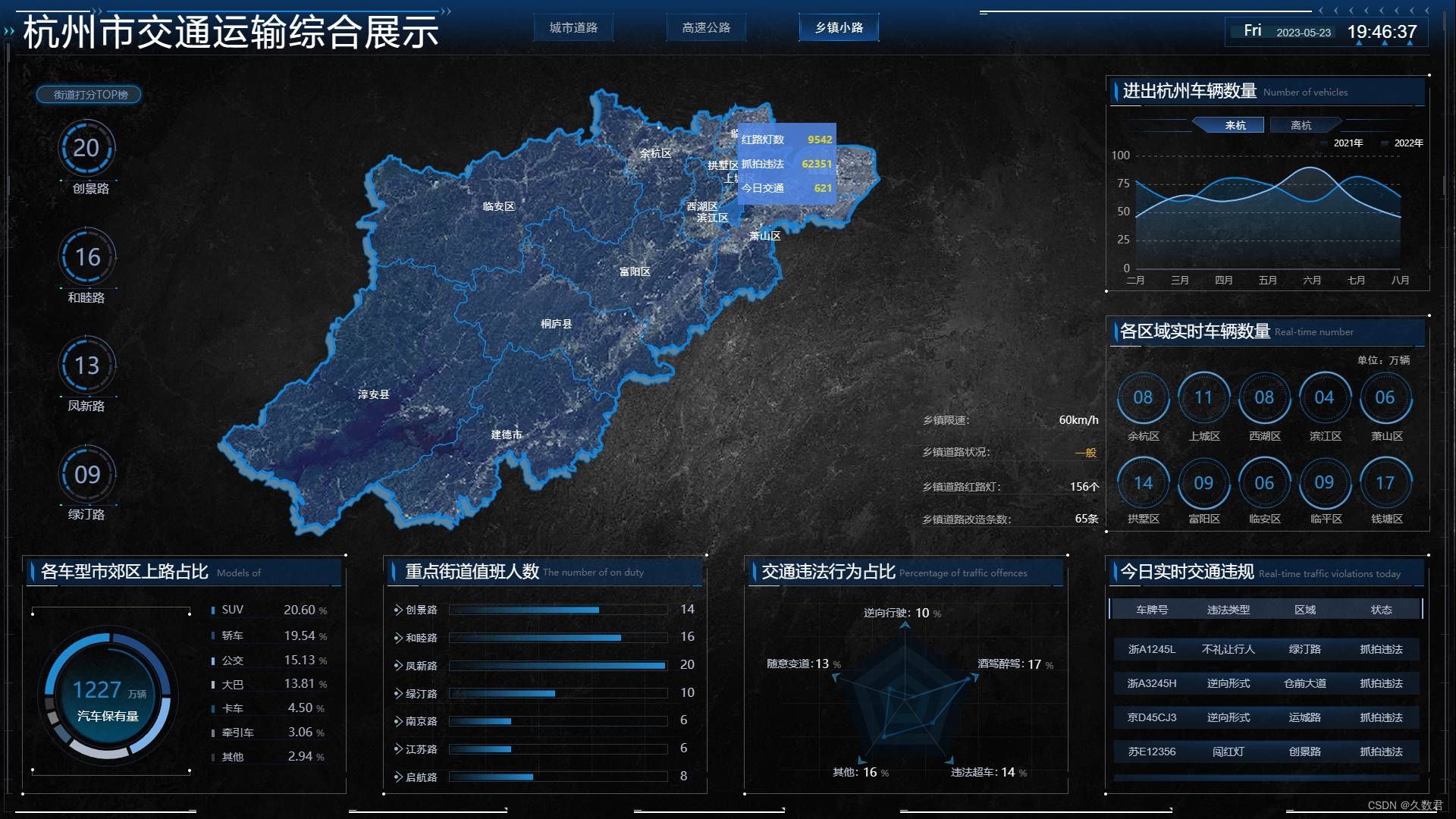
② GIS technology can realize the visual display of urban data. A large amount of urban data often exists in digital form, which is difficult for ordinary people to understand and use intuitively. GIS technology converts abstract data into vivid images through maps, charts and other visualization methods, making the data more intuitive and easy to understand. This provides city managers and decision makers with a more convenient and intuitive basis for decision-making, helping them better grasp the context and trends of urban development.
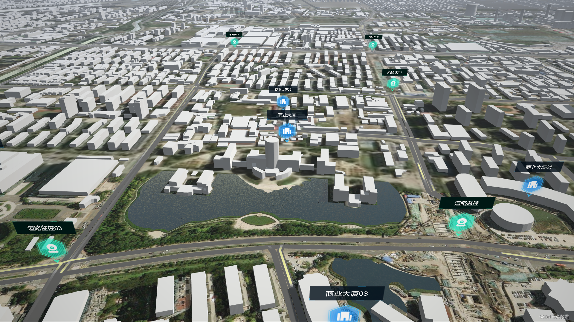
Mountain Sea Whale Visualization GIS Terrain Scene
③ GIS technology has the ability of spatial analysis, which can help urban managers to carry out refined management. Through GIS technology, urban managers can conduct accurate spatial analysis and simulation of urban resources, transportation networks, and environmental quality. For example, in terms of traffic management, GIS technology can optimize the timing of traffic lights and improve traffic flow through traffic hotspot analysis and congestion prediction. In terms of environmental protection, GIS technology can carry out environmental monitoring and analysis of pollution sources, helping city managers to discover and solve environmental problems in a timely manner. These means of refined management can improve the operating efficiency of the city and improve the quality of life of residents.

Mountain Sea Whale visualization large screen
④ GIS technology can also be integrated with other smart city technologies. Smart city construction is not just the application of a single technology, but the integration of multiple technologies. The combination of GIS technology with Internet of Things, big data, artificial intelligence and other technologies can realize more intelligent urban management and services. For example, by combining sensor data with geographic information, remote monitoring and management of urban facilities can be realized; by combining big data with geographic information, analysis and prediction of urban flow of people and traffic flow can be realized. These comprehensive applications can provide city managers with more comprehensive and accurate information support, and help the construction of smart cities achieve greater results.
Mountain Sea Whale visualization large screen
In short, GIS technology plays an important role in the construction of smart cities. With its unique geospatial analysis capabilities, it helps city managers better understand cities, plan cities, optimize cities, and promote the intelligent and efficient development of cities. In the future, with the continuous innovation and development of technology, GIS technology will further enhance its role in the construction of smart cities and create a smarter and more livable urban environment for us.