Landsat7_C2_SR数据集是经大气校正后的地表反射率数据,属于Collection2的二级数据产品,空间分辨率为30米,基于Landsat生态系统扰动自适应处理系统(LEDAPS)(版本3.4.0)生成。水汽、臭氧、大气高度、气溶胶光学厚度、数字高程与Landsat数据一起输入到太阳光谱(6S)辐射传输模型中对卫星信号进行二次模拟,以生成大气顶部(TOA)反射率、表面反射率、TOA亮度温度和云、云影、陆地、水体的掩膜。2003年6月以来,因扫描线校正器(SLC)故障导致传输数据存在间隙问题。前言 – 人工智能教程
Landsat7_C2_SR数据集是Landsat7卫星的一种数据产品,提供每个卫星场景的反射率值。这个数据集使用了Landsat生态系统干扰自适应处理系统(LEDAPS),对大气效应进行了校正,并考虑了地形变化。这使得对地表特性和时间变化进行更准确的分析成为可能。这个数据集可以从美国地质调查局的Earth Explorer网站免费下载。
Landsat 7卫星的传感器为ETM+传感器,它有8个波段,其中第一波段为蓝色波段,第二波段为绿色波段,第三波段为红色波段。由于该传感器的扫描镜头故障,在接收到的数据中存在条带状的颜色差异,导致图像质量下降。修复该问题的一种方法是使用更高分辨率的传感器数据来填充缺失的数据。
具体的修复GEE代码:
GEE教程——Landsat7影像条带修复填充方法(核函数线性插值填充)填充后的NDVI为例-CSDN博客
| 名称 | 单位 | 最小值 | 最大值 | 乘法比例因子 | 加性比例因子 | 波长范围(微米) | 描述 |
|---|---|---|---|---|---|---|---|
| B1 | Reflectance | 1 | 65455 | 0.0000275 | -0.2 | 0.45-0.52 | Band 1 (blue) surface reflectance |
| B2 | Reflectance | 1 | 65455 | 0.0000275 | -0.2 | 0.52-0.60 | Band 2 (green) surface reflectance |
| B3 | Reflectance | 1 | 65455 | 0.0000275 | -0.2 | 0.63-0.69 | Band 3 (red) surface reflectance |
| B4 | Reflectance | 1 | 65455 | 0.0000275 | -0.2 | 0.77-0.90 | Band 4 (near infrared) surface reflectance |
| B5 | Reflectance | 1 | 65455 | 0.0000275 | -0.2 | 1.55-1.75 | Band 5 (shortwave infrared 1) surface reflectance |
| B7 | Reflectance | 1 | 65455 | 0.0000275 | -0.2 | 2.08-2.35 | Band 7 (shortwave infrared 2) surface reflectance |
| SR_ATMOS_OPACITY | Unitless | 0 | 10000 | 0.001 | A general interpretation of atmospheric opacity generated by LEDAPS and based on the radiance viewed over Dark Dense Vegetation (DDV) within the scene. A general interpretation of atmospheric opacity is that values (after scaling by 0.001 is applied) less than 0.1 are clear, 0.1-0.3 are average, and values greater than 0.3 indicate haze or other cloud situations. SR values from pixels with high atmospheric opacity will be less reliable, especially under high solar zenith angle conditions. The SR_ATMOS_OPACITY band is provided for advanced users and for product quality assessment and has not been validated. Most users are advised to instead use the QA_PIXEL band information for cloud discrimination. | ||
| SR_CLOUD_QA | Bit index | 1 | 56 | Cloud Quality Assessment | |||
| QA_PIXEL | Bit Index | 5440 | 16382 | Landsat Collection 2 QA Bitmask | |||
| QA_RADSAT | Bit Index | 0 | 3829 | Radiometric saturation QA |
代码:
/**
 * @File    :   Landsat7_C2_SR_T1
 * @Time    :   2023/03/07
 * @Author  :   GEOVIS Earth Brain
 * @Version :   0.1.0
 * @Contact :   中国(安徽)自由贸易试验区合肥市高新区望江西路900号中安创谷科技园一期A1楼36层
 * @License :   (C)Copyright 中科星图数字地球合肥有限公司 版权所有
 * @Desc    :  数据集key为LANDSAT_7/02/T1/SR的Landsat7_C2_SR类数据集
 * @Name    :   Landsat7_C2_SR_T1数据集
*/
//指定检索数据集,可设置检索的空间和时间范围,以及属性过滤条件(如云量过滤)
var imageCollection = gve.ImageCollection("LANDSAT_7/02/T1/SR")
                    .filterCloud('lt',20)
                    .filterDate('2022-01-20','2022-02-15')
                    .select(['B1','B2','B3'])
                    .limit(10);

print("imageCollection",imageCollection);

//function applyScaleFactors(image) {
//    var opticalBands = image.select('B.*').multiply(0.0000275).add(-0.2);
//    return image.addBands(opticalBands, null, true)
//}
//
//var img = imageCollection.map(applyScaleFactors).first();
var img = imageCollection.first();

print("first", img);

var visParams = {
//    min: 3624,
//    max: 65535,
//    gamma: 1,
//    brightness: 1,
    bands: ['B3', 'B2', 'B1']
};

Map.centerObject(img);
Map.addLayer(img,visParams);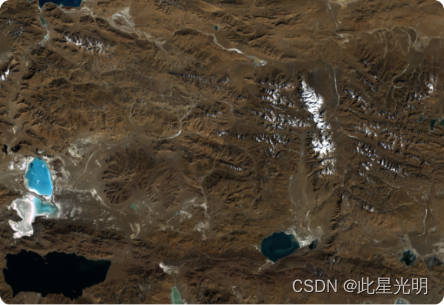
Landsat 数据集属于国际公开数据,可以在没有版权限制的情况下使用、传输或复制。有关USGS数据产品正确引用的更多详细信息,请参阅USGS Visual Identity System Guidancehttps://www.usgs.gov/information-policies-and-instructions/usgs-visual-identity-system