Function list:
1. Support 2D and 3D map display loading;
2. Support cluster UAV distribution positioning and machine nest positioning;
3. Support real-time display of real-time weather data of various districts and counties, and can display the weather forecast data of the area for 2 weeks in detail;
4. Support the management of different geographic information layers, including: orthophoto layers, terrain layers, real-world 3D modeling layers, route layers and vector layers;
5. Support drone airspace conditions (no-fly zone, restricted-fly zone) to be displayed on the map;
6. Support online calculation of distance, area, height and triangulation on the map;
7. Support to formulate tasks for the machine nest and display the task list of the machine nest;
8. Support importing planned drone route files in KML format;
9. Click on the map with the mouse to draw the route setting parameters: flight altitude, take-off and landing altitude, flight direction, lateral overlap, heading overlap, height of surveying and mapping reference plane, single flight time, gimbal angle, flight speed, Round-trip speed, nose orientation, return mode setting functions, total route length, mission length, round-trip length, number of waypoints, flight time estimation functions, automatic route adjustment according to different UAVs and mounted models;
10. Support setting panoramic collection tasks, calling drones to collect panoramic photos of the emergency scene, and displaying the panoramic photos of the emergency scene online through the inspection system;
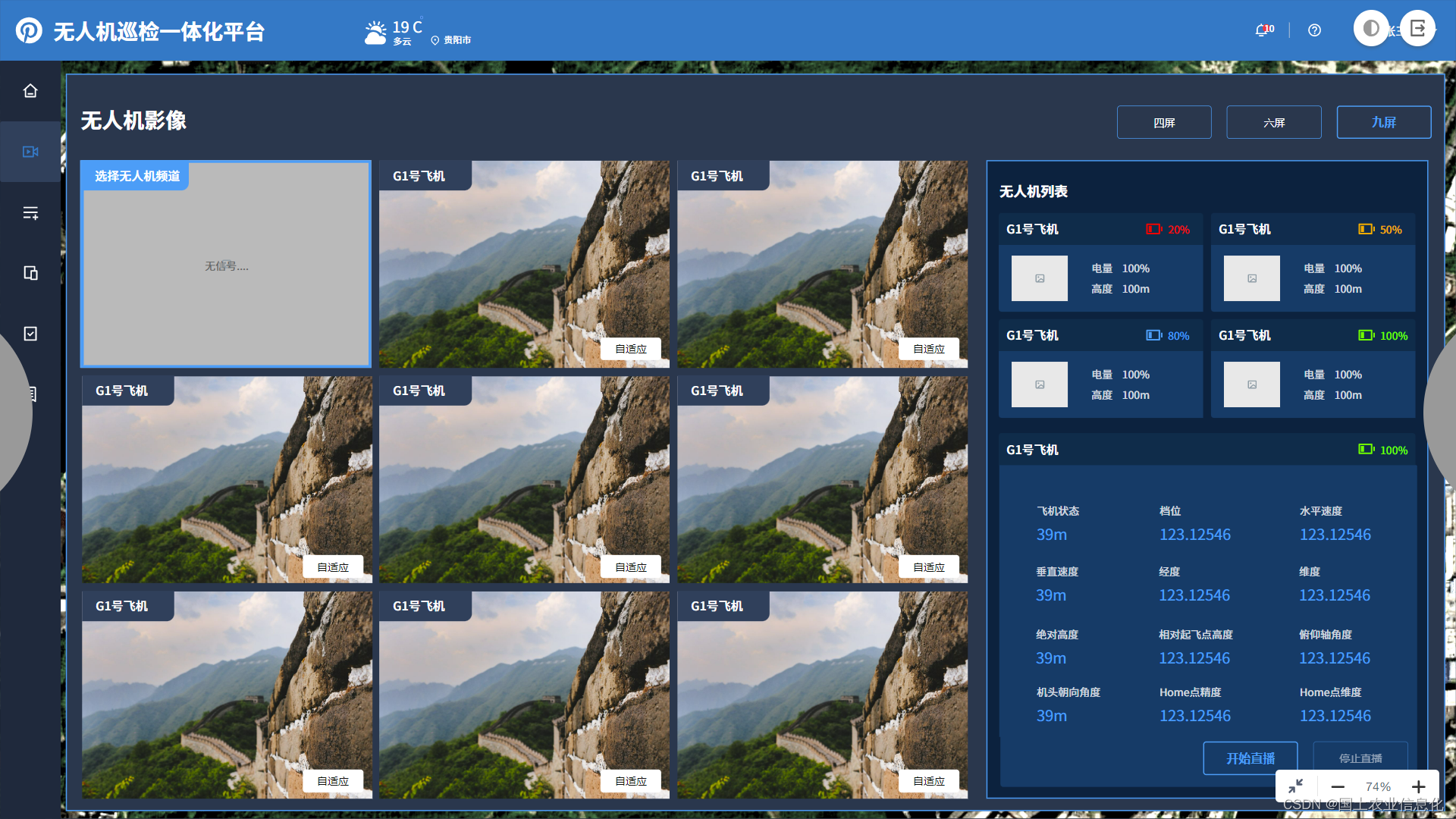
11. During the operation process, the screen can be sent back to the system in real time, and the staff can view the drone operation screen in real time;
12. Support the statistics of the total number of tours, the statistics of the number of tours today, the change trend of the number of tours, the statistics of the number of tours of different base stations, the total number of tour photos, and the total number of tour videos.
13. Support rtmp push live broadcast, obtain live broadcast information parameters.
Some functions support business scenarios such as emergency dispatch and patrol inspection. Currently compatible with DJI Mavic series, Phantom series, M300 and other models.