- 应用背景:
很多时候,我们需要使用网络上的遥感影像或者百度地图、天地图等在线地图做一些矢量化工作或者其他。
笔者见过很多人都是把百度地图截图,然后把图片导如Arcmap或者Arcgis pro中,然后进行矢量化操作(规划专业某女同学经常这样做……)
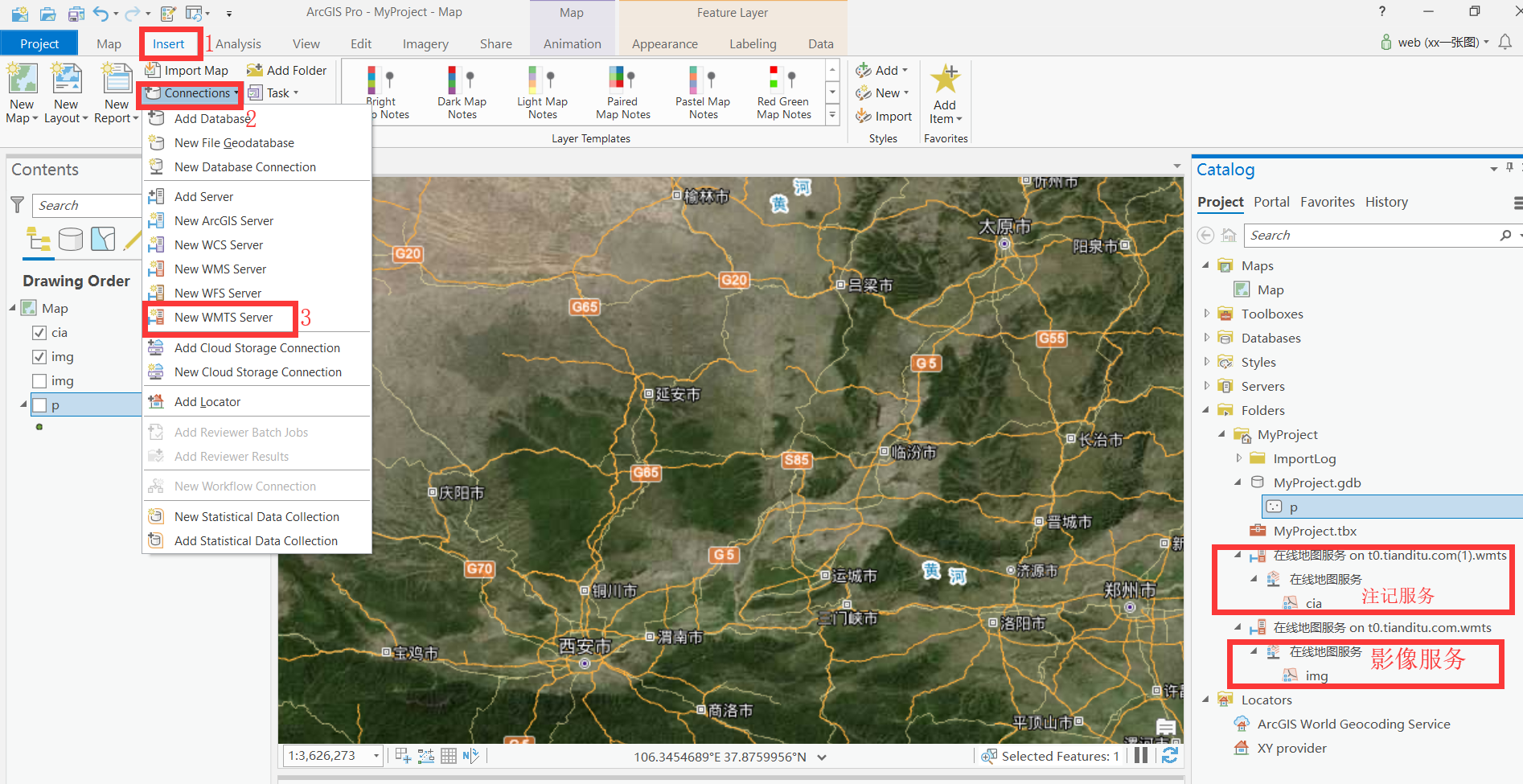
鉴于此,根据大佬提示,本人亲测在最新版本的arcgis pro2.3中加入天地图服务。
下面是具体步骤:
- 操作步骤:
- 注册天地图服务。http://www.tianditu.gov.cn/
- 在控制台随便创建应用。

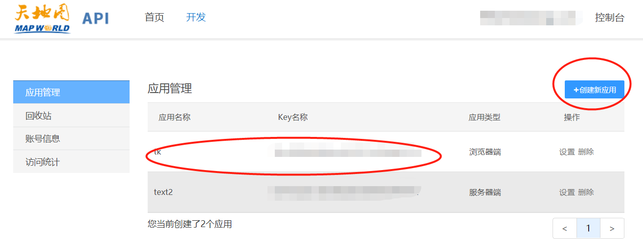
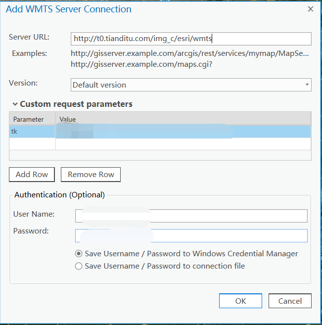
第3步中:需要用到1步中的申请的tk号码。填上天地图注册的用户名和密码。就ok了。
参考资料和致谢:
1、张哥的博客:https://blog.csdn.net/gislaozhang/article/details/87009767
2、https://www.cnblogs.com/liweis/p/9528148.html
3、关于服务地址的说明:
不偏移的天地图地图服务-ArcGIS版
地图偏移和纠偏是使用在线电子地图不可避免的话题。研究不深入,暂且分享一种已纠偏的地图服务。
服务地址
影像地图:
http://t0.tianditu.com/cia_w/esri/wmts 天地图影像注记(墨卡托,WGS1984)
http://t0.tianditu.com/img_w/esri/wmts天地图影像(墨卡托,WGS1984)
http://t0.tianditu.com/cia_c/esri/wmts 天地图影像注记(经纬度,CGCS2000)
http://t0.tianditu.com/img_c/esri/wmts 天地图影像(经纬度,CGCS2000)
街道地图:
http://t0.tianditu.com/cva_w/esri/wmts 天地图街道注记(墨卡托,WGS1984)
http://t0.tianditu.com/vec_w /esri/wmts天地图街道(墨卡托,WGS1984)
http://t0.tianditu.com/cva_c/esri/wmts 天地图街道注记(经纬度,CGCS2000)
http://t0.tianditu.com/vec_c/esri/wmts 天地图街道(经纬度,CGCS2000)
可以了解一下与其他有偏移的服务: