Signal processing is a common subject in electrical engineering, communication engineering and mathematics that deals with analysis and processing of analog and digital signals, and deals with storing, filtering, and other operations on signals, including transmission signals, sound or voice signals, image signals, and other signals e.t.c.
Out of all these signals, the field that deals with the type of signals for which the input is an image and the output is also an image is called digital image processing.
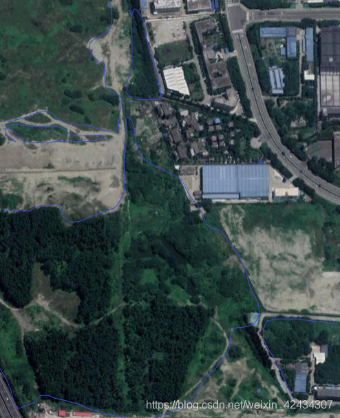
The object of this blog is to detect and extract forest areas in an aerial image through a series of image processing that can be a formed into a regular and feasible method when dealing with all images of this type.
The method is mainly based on the analysis of color which shows great differences as forest and other region areas appear in the image with different color. An additional measure of heterogeneity is used to distinguish certain fields like agricultural areas which share the same green color but in different levels with the forest areas.

Step 1
Image smoothing and noise reduction are the underlying processes. Noise may occur in the process of image acquisition and quantification, or in the process of image compression and transmission. The existence of noise greatly interferes with the information of the image and has an impact on the subsequent processing and analysis of the image
Always the image needs some basic processing to reduce the acquisition and compression artifacts.
The image is smoothed with a Gaussian low-pass filter in order to reduce noise and block effect due to JPEG image encoding.
Step 2
To focus on the green color, we need to analyse the color saturation and brightness. The principle is to select in the image only the pixels with hue value between 110° and 200°, which correspond to green pixels.
Step 3
To select the dark areas, only those pixels with a low luminance value, namely a value between 0 and 60, are selected.
Step 4
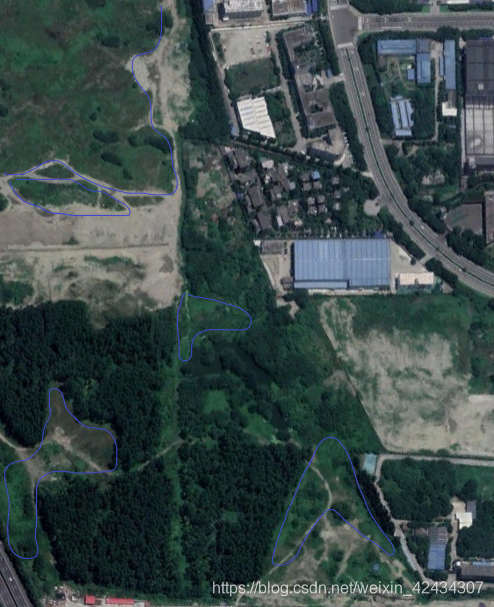
By combining the two previous results, the green dark regions are detected.
Step 5
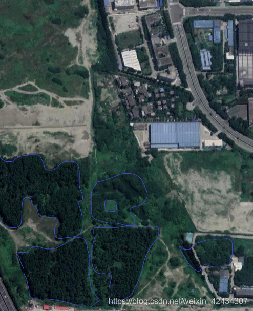
After above procedures, there are still some agricultural fields. To remove the fields from the result, we use the variance since the forested areas are more heterogeneous than the fields because of the foliage). We keep from the previous regions, selecting only those which have a variance greater than 50.
Step 6
There are still some regions with the shape of little points, which in fact refer to some single trees that can not be considered as a forest.
These regions are removed using the surface area. We keep only regions with surface area ≥ X pixels.
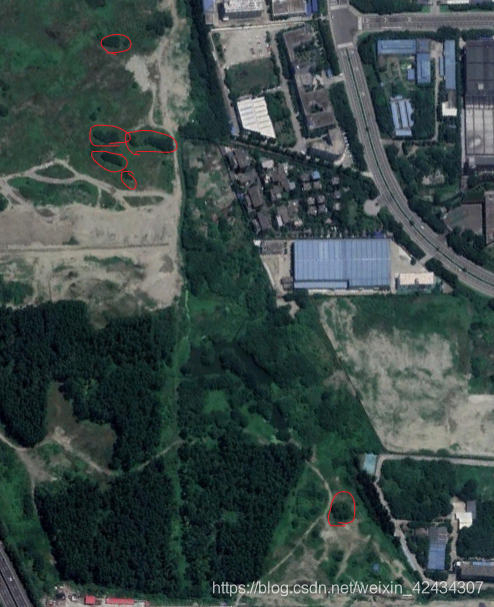
All images come from Google Earth
https://earth.google.com/web/@30.74240431,103.94485602,524.92033814a,2120.75664573d,35y,36.65948225h,0t,0r