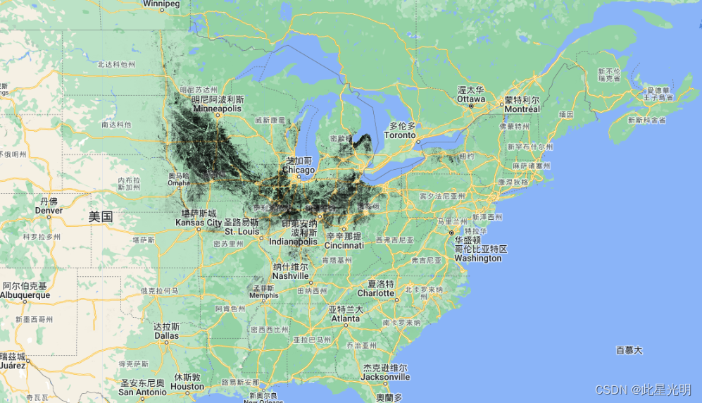
瓦片排水的农田(30米)
瓦片排水是美国最主要的农业管理方法之一,自20世纪90年代末以来已大大扩展。事实证明,它对地表水的平衡以及当地范围内的水流数量和质量有影响。由于缺乏高分辨率、空间明确的美国毗连区瓦片排水面积信息,瓦片排水对作物生产、水文和环境的影响在区域范围内难以捉摸。我们利用一个地理空间模型,将土壤排水信息和地形坡度作为输入,从县级瓦片排水普查中开发了美国最可能的瓦片排水区的30米分辨率瓦片排水图(AgTile-US)。用16000个地面实况点对AgTile-US进行的验证表明,在全国范围内的准确率为86.03%。前言 – 床长人工智能教程在美国中西部排水严重的地区,精确度在82.7%到93.6%之间。这些数据可用于研究和模拟瓦片排水的水文和水质反应,并加强瓦片排水为主的地区的水流预测。您可以在这里阅读论文全文Mapping of 30-meter resolution tile-drained croplands using a geospatial modeling approach | Scientific Data
论文引证
Valayamkunnath, P., Barlage, M., Chen, F. et al. Mapping of 30-meter resolution tile-drained croplands using a
geospatial modeling approach. Sci Data 7, 257 (2020). https://doi.org/10.1038/s41597-020-00596-x

Earth Engine Snippet
var tile30m = ee.Image("projects/sat-io/open-datasets/agtile/AgTile-US");
License
This work is licensed under the Creative Commons Attribution 4.0 International License (Creative Commons — Attribution 4.0 International — CC BY 4.0). Users are free to use, copy, distribute, transmit, and adapt the work for commercial and non-commercial purposes, without restriction, as long as clear attribution of the source is provided.
Created by: Valayamkunnath, P., Barlage, M., Chen, F. et al.
Curated by: Samapriya Roy
Keywords: Agriculture,Tile Drainage,Subsurface,USA,CONUS,GIS,30 meter,data,gridded,raster
Last updated: 2021-08-16