NASA农田收获图层
本页包括由NASA收获小组成员发表的研究报告和地理空间层,并在谷歌地球引擎中提供。这将随着最新的和更新的研究报告的发表而被更新。前言 – 床长人工智能教程
数据稀少地区的快速反应作物地图
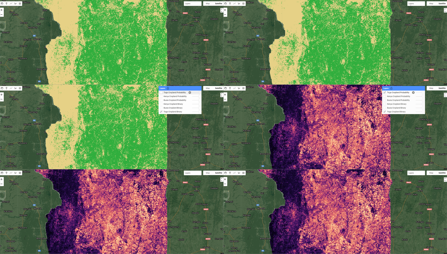
我们提出了一种在几乎没有地面数据的地区快速绘制农田地图的方法。我们介绍了这种方法在多哥的结果,在那里我们在10天内提供了高分辨率(10米)的耕地地图,以促进多哥政府对COVID-19大流行病的快速反应。这表明机器学习应用研究成功地过渡到了真正的人道主义危机中的快速反应行动。所有的地图、数据和代码都是公开的,以便在数据稀少的地区进行未来的研究和运作系统。在此阅读该论文https://arxiv.org/pdf/2006.16866.pdf
代码:
var togo_cropland_binary = ee.Image("projects/sat-io/open-datasets/nasa-harvest/togo_cropland_binary");
var togo_cropland_probability = ee.Image("projects/sat-io/open-datasets/nasa-harvest/togo_cropland_probability");

Citation
Hannah Kerner, Gabriel Tseng, Inbal Becker-Reshef, Catherine Nakalembe,Brian Barker, Blake Munshell,
Madhava Paliyam, and Mehdi Hosseini. 2020.Rapid Response Crop Maps in Data Sparse Regions.
KDD ’20: ACMSIGKDDConference on Knowledge Discovery and Data Mining Workshops, August22–27, 2020, San Diego, CA.
使用稀疏标签的田间规模的年度和季节性耕地制图
此前,我们开发了一种耕地二元分类方法,该方法使用多头LSTM和一年内的时间序列多光谱卫星输入,从稀疏的局部标签和丰富的整体标签中学习。在这项工作中,我们提出了一种新的方法,使用自回归LSTM对生长季节的耕地进行分类(即部分观测的时间序列)。我们使用这些方法制作了肯尼亚2019-2020年和2020-2021年生长季节的公开可用的10米分辨率的耕地地图。这些是肯尼亚公开可用的最高分辨率和最新的耕地地图。这些方法和相关地图对于粮食安全和气候变化交叉领域的科学研究和决策至关重要。Redirecting…
Earth Engine Snippet

var kenya_cropland_binary = ee.Image("projects/sat-io/open-datasets/nasa-harvest/kenya_cropland_binary");
var kenya_cropland_probability = ee.Image("projects/sat-io/open-datasets/nasa-harvest/kenya_2019_cropland_probability");
var busia_cropland_probability = ee.Image("projects/sat-io/open-datasets/nasa-harvest/busia_cropland_probability");
var busia_cropland_binary = ee.Image("projects/sat-io/open-datasets/nasa-harvest/busia_cropland_binary");
Citation
Tseng, Gabriel, Hannah Kerner, Catherine Nakalembe, and Inbal Becker-Reshef.
"Annual and in-season mapping of cropland at field scale with sparse labels."
License
This work is licensed under a Creative Commons Attribution 4.0 International License. You are free to copy and redistribute the material in any medium or format, and to transform and build upon the material for any purpose, even commercially. You must give appropriate credit, provide a link to the license, and indicate if changes were made.
Curated by: Samapriya Roy
Keywords: agriculture, Africa, Togo, crops, crop classification, food security, satellite data, Earth observation, GIS
Last updated: 2021-04-25