一、获得当前定位(无路线显示)
1、map.xml
|
<
map
longitude=
'{{longitudes}}'
latitude=
'{{latitudes}}'
scale=
'14'
show-location
style=
"width: 100%; height: 400px;"
>
|
|
注释:
longitude: 中心经度(number),因是实时定位,具体值在js文件中定义
latitude : 中心纬度(number)
scale : 缩放级别(number) 默认:16 取值范围:5-18 markers : 标记点用于在地图上显示标记的位置(数组) show-location-style:显示带有方向的当前定位点 |
2、map.js
|
Page({
/**
* 页面的初始数据
*/
data: {
},
/**
* 生命周期函数--监听页面加载
*/
onLoad:
function (options) {
console.log(
'mapload...');
var that =
this
wx.getLocation({
type:
'wgs84',
success:
function (res) {
console.log(
'纬度' + res.latitude);
console.log(
'经度' + res.longitude);
that.setData({
latitudes: res.latitude,
longitudes: res.longitude,
})
},
})
},
})
|
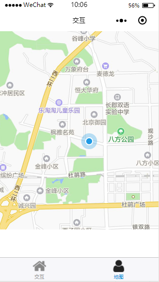
3、效果图
二、获得当前定位(有路线显示)
1、map.xml
|
<
map
longitude=
'{{longitudes}}'
latitude=
'{{latitudes}}'
scale=
'14'
show-location
style=
"width: 100%; height: 400px;"
polyline
='{{polyline}}'
>
|
|
注释:
longitude: 中心经度(number),因是实时定位,具体值在js文件中定义
latitude : 中心纬度(number)
scale : 缩放级别(number) 默认:16 取值范围:5-18 markers : 标记点用于在地图上显示标记的位置(数组) show-location-style:显示带有方向的当前定位点
polyline: 路线(数组)
|
2、map.js
|
Page({
/**
* 页面的初始数据
*/
data: {
},
/**
* 生命周期函数--监听页面加载
*/
onLoad:
function (options) {
console.log(
'mapload...');
var that =
this
wx.getLocation({
type:
'wgs84',
success:
function (res) {
console.log(
'纬度' + res.latitude);
console.log(
'经度' + res.longitude);
that.setData({
latitudes: res.latitude,
longitudes: res.longitude,
polyline: [{
points: [
{
longitude: res.longitude, // 起始点经度
latitude: res.latitude // 起始点纬度
}, {
longitude: 112.9388700000, //目标地点经度
latitude: 28.2269300000 //目标地点纬度
// 可搜索网站 在线经纬度查询:http://www.gpsspg.com/maps.htm
// 在此网站输入自己的目标地址即可得到此地址的经度和纬度
}
],
color: "#000000AA", //线的颜色
width: 2, //线的宽度
dottedLine: true //是否为虚线
}],
})
},
})
}
})
|
3、效果图

emmmm....话说这线路....画的好随意阿....