In today's work, we need to count the number of demolished houses (total area) within the scope of road construction land and mark them in CAD. In order to improve production efficiency and reduce human calculation errors, we hope to use ArcGis's functions such as area geometry calculation, location selection, automatic standard, and element conversion to CAD to realize automatic calculation and labeling.
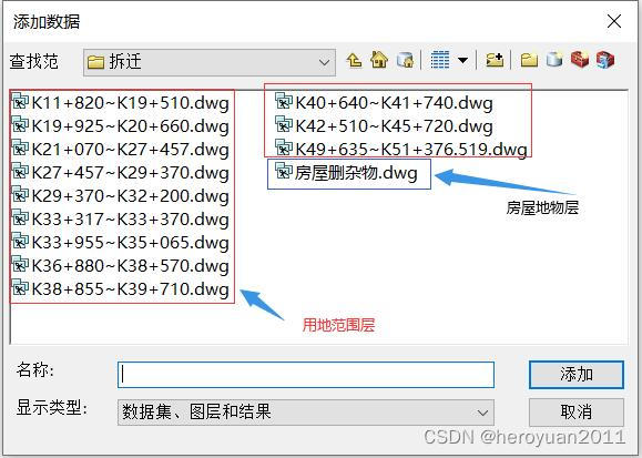
Data situation: The scope of road construction land is in CAD format; the housing data is in CAD format, including the text marked with the number of floors and the nature of the building.

General idea: convert CAD housing plots into ArcGis surface elements, convert texts containing marked layers and building properties into point elements, use point elements to assign information such as storey height and building properties to surface elements, and then use roads Select the location of the construction land range to extract the houses that need to be demolished and make statistics.
The workflow is as follows:
1. Add the CAD file to ArcGis.
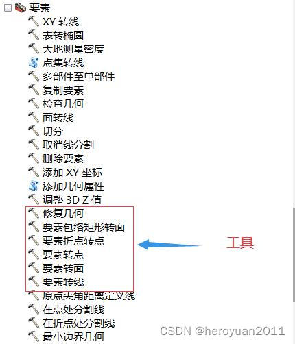
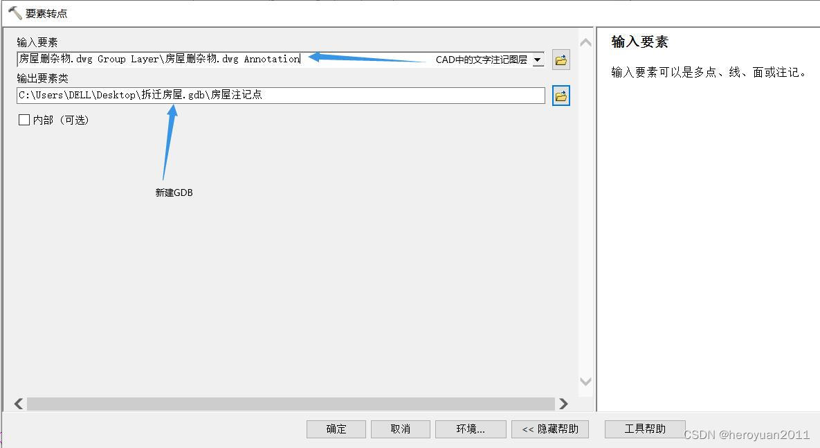
 2. Use the feature-to-point tool in the Data Management Tools toolbox to convert the text containing the number of layers and the text of the building property into a point feature.
3. Use the feature-to-surface tool in the Data Management Tools toolbox to convert the CAD housing plot into a polygon feature and use the house annotation point feature to assign values.

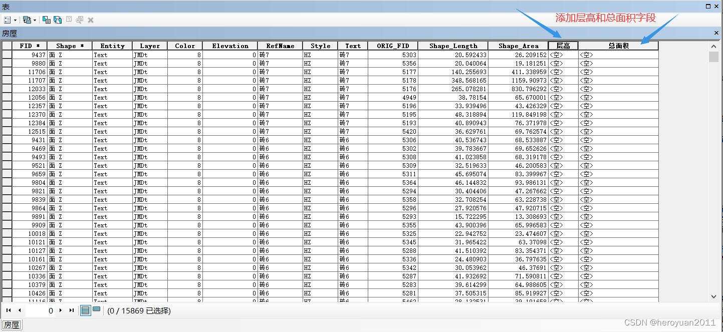
4. Add the number of floors and total area fields for the housing plot polygon elements, and calculate the fields. The layer height field uses the right() function, and the total area is the layer height × shape-area.


5. Select by location, select houses within the range of road land and export vector data.

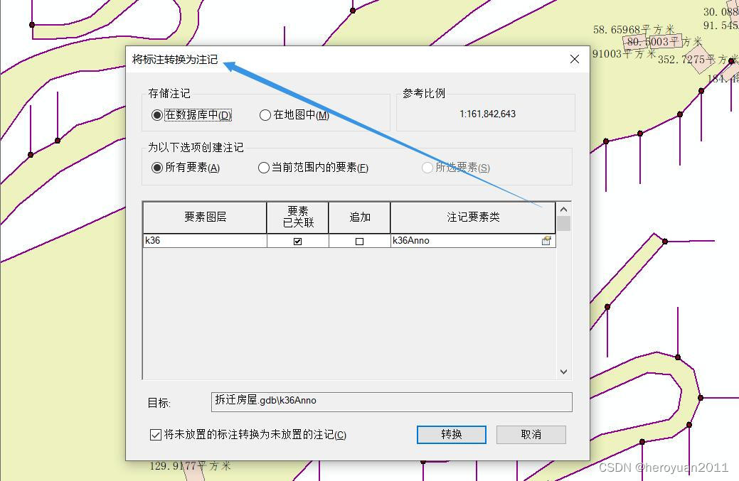
6. Mark the elements of the exported house demolition data, the expression is: total area & "square meter", and convert the mark into a note.

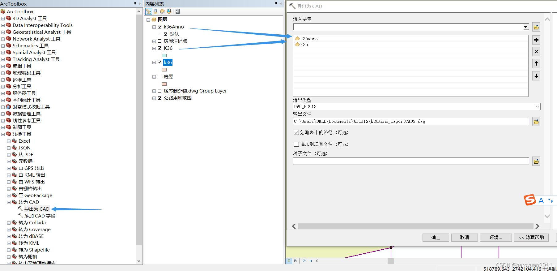
7. Export annotation and demolition house surface to CAD.
8. Copy the notes and CAD files of demolished houses, and paste the original coordinates into the CAD of the road land use range.
