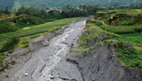
Geological disasters such as mountain torrents and mud-rock flows have the characteristics of suddenness, rapid flow, large flow, large material capacity and strong destructive power. The occurrence of mountain torrents and debris flows often washes away roads and railways and other transportation facilities and even villages and towns, causing huge losses.
Mountain torrents and debris flows generally occur in mountainous areas, semi-arid mountainous areas, and plateau glacier areas. my country is a mountainous country, and the hilly area accounts for about two-thirds of the country. Due to the large population, high density and wide distribution of the hilly area, as well as the uneven temporal and spatial distribution of rainfall caused by the typical monsoon climate, and complex topographical geological factors, during the annual flood season, with heavy rains or melting glaciers, it is easy to form mountain torrents Mudslides. The lives and property safety of the broad masses of people living in hilly areas will face serious threats from disasters such as mountain torrents, mudslides and landslides, of which 74 million people will be directly affected.
The defense strategy of geological disasters is "prevention first, and prevention is more important than grabbing". The method of defense and prevention is to adopt engineering measures to improve engineering prevention standards, and also to adopt non-engineering measures, establish a comprehensive disaster prevention and reduction system, and improve disaster prevention. Anti-risk ability.
In summary, the establishment of a geological disaster monitoring and early warning system is an important non-engineering measure to prevent and control mountain torrents, mudslides, landslides and other geological disasters.
System goal
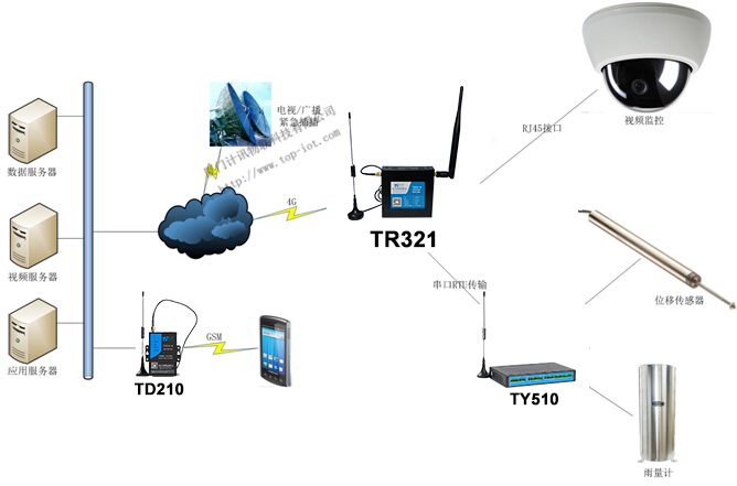
The geological disaster monitoring system mainly includes the layout of rain monitoring stations, geological disaster monitoring stations, video stations, information collection, information transmission communication networking, equipment and facilities configuration, etc. The system should integrate field data collection, wireless data transmission, and central data processing. It can collect various rainfall, displacement, video and other parameters in real time on the spot, and transmit them to the central data platform in a timely and accurate manner through the wireless network. The transmitted data is processed and analyzed, real-time and accurately grasped and displayed on-site rain information and geological changes, combined with on-site video images to generate early warning information in time. When geological disasters occur, the system can effectively issue early warning signals to remind local people to prevent or evacuate in time.
system structure
The geological disaster monitoring system is mainly composed of four parts: front-end signal acquisition, data wireless transmission, background data processing and display, early warning information release, etc., as shown in the following figure:
to sum up
The geological disaster monitoring and early warning system includes: rain monitoring, displacement monitoring, etc. to collect on-site rainfall and mountain displacement data. The wireless data collection and transmission terminal RTU collects and returns the data to the central platform, and the platform analyzes and processes the data and provides early warning. In order to reduce the loss of people's lives and property caused by geological disasters.
The geological disaster monitoring system has the following characteristics:
(1) Reliability: The system can ensure long-term safe operation. The hardware and software in the system have protection mechanisms such as crash prevention to meet the reliability design requirements.
(2) Fault tolerance: The acquisition system has high acquisition accuracy; the system has high fault tolerance; it has strong anti-interference.
(3) Adaptability: The system has multiple communication methods for backup and complementation, which can ensure the coverage area of early warning and is highly adaptable to the terrain environment.
(4) Expandability: The hardware and software of the system can be upgraded, and functions can be added.
(5) Ease of operation: The on-site hardware equipment is simple to operate, easy to learn and master, suitable for environments such as mountainous and rural areas, and the software interface is easy to operate.