Key words: three levels of provinces and municipalities, four levels of townships, the whole country, administrative divisions, coordinate boundaries, vector data, geofencing, free download, 2018, 2019, 2020, 2021, and 2022 years, latest data, long-term updates, open source maintenance, support for SHP GeoJSON SQL format, supports importing database
Three-level coordinate boundary data of provinces and municipalities across the country
- Data size: 13MB+ compressed package after decompression 130M+
- Data source: AutoNavi Open Platform
- File format: csv general plain text format (can be converted into shp, geojson, sql, import database)
- File name: ok_geo.csv.7z
- Coordinate system: default GCJ-02 (can be converted into WGS-84, CGCS2000, BD-09 and other coordinate systems)
- Update frequency: The open source library is updated once a month (directly synchronized from Gaode, it will take longer when you are busy)
National Township Street Coordinate Boundary Data
- Data size: 90MB+ 300M+ after the compressed package is exported
- Data source: integration of multiple data sources
- File format: csv general plain text format (can be converted into shp, geojson, sql, import database)
- File name: ok_geo4_*.csv.7z
- Coordinate system: default GCJ-02 (can be converted into WGS-84, CGCS2000, BD-09 and other coordinate systems)
- Update frequency: reintegrate about half a year (not open source)
Attachment: Four-level administrative division data of provinces, cities, towns and towns
- Data size: 3MB+
- Data source: National Bureau of Statistics, Ministry of Civil Affairs, Tencent Map, Gaode Map
- File format: csv general plain text format (can be imported into database and converted into multi-level linkage js code)
- File name: ok_data_level4.csv
- Update frequency: the open source library is updated within half a month when the data source is updated
Preview and download address
Data download address: https://xiangyuecn.gitee.io/areacity-jsspider-statsgov/
Online preview address: https://xiangyuecn.gitee.io/areacity-jsspider-statsgov/assets/geo-echarts.html (provided ECharts + Gaode map four-level drill-down code)
Open Source Library (GitHub): https://github.com/xiangyuecn/AreaCity-JsSpider-StatsGov
Open Source Library (Gitee): https://gitee.com/xiangyuecn/AreaCity-JsSpider-StatsGov
screenshot preview
The update time of the data in the screenshot below: 2022-04-08, as time goes by, it may be different from the latest data.
Online preview (ECharts + Gaode Map four-level drill-down):
Three-level boundaries of provinces and cities (ArcMap Mercator projection):
National town boundaries (ArcMap Mercator projection):
Cities and towns in Hubei Province (QGIS Mercator projection):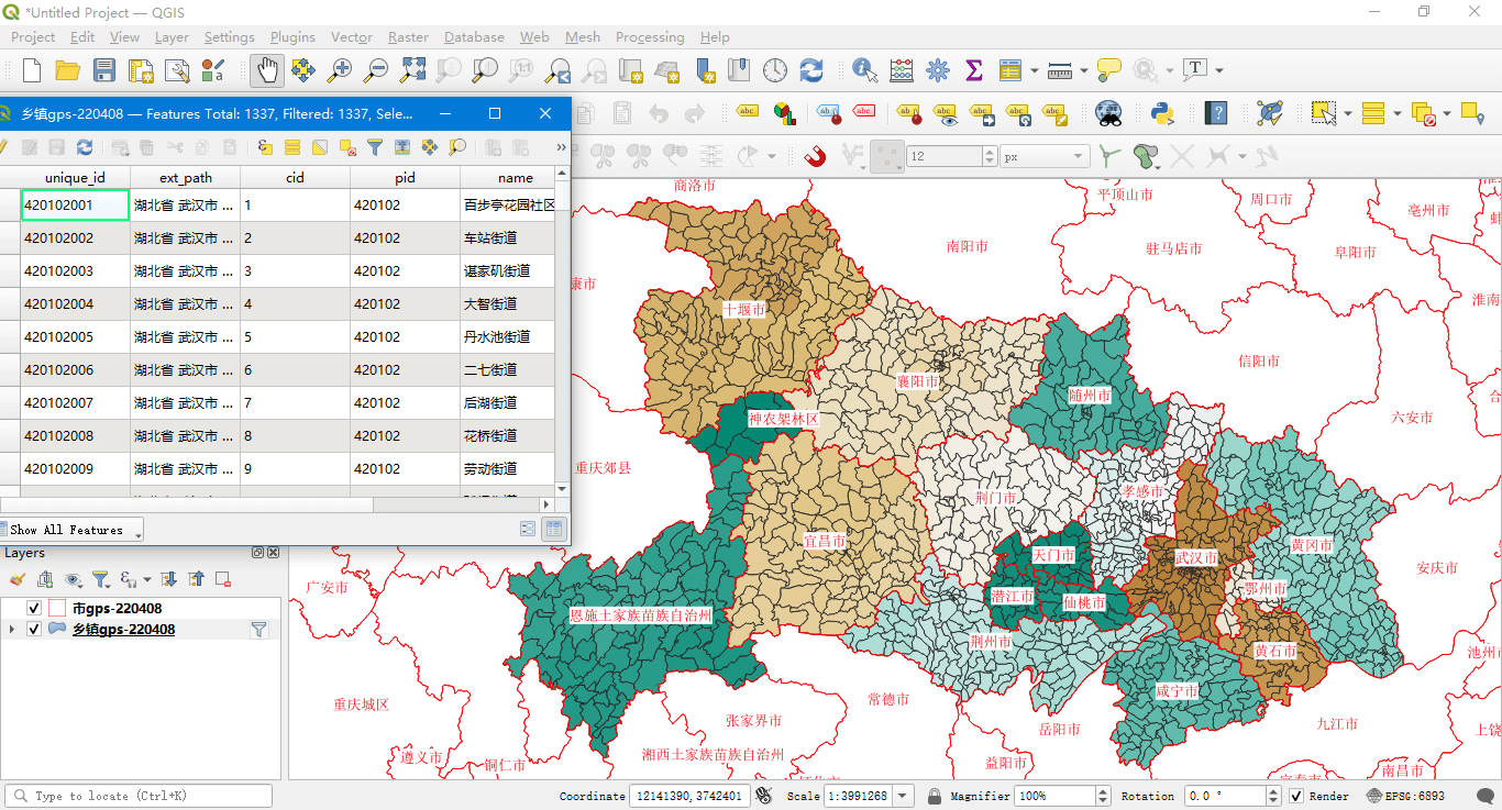
Townships in Hubei Province (SQL Server query space results):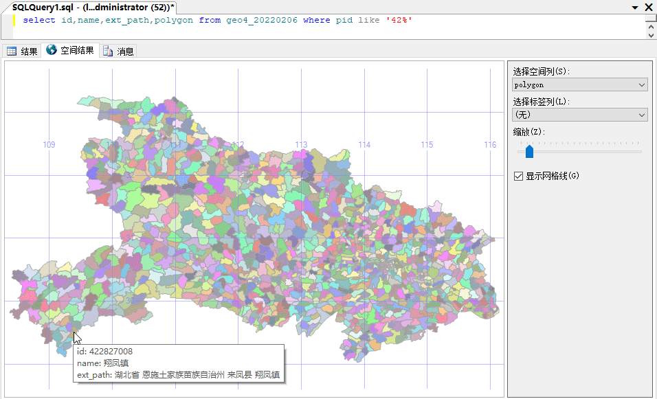
Attached four-level administrative division data of provinces, municipalities, towns and towns (export and four-level linkage):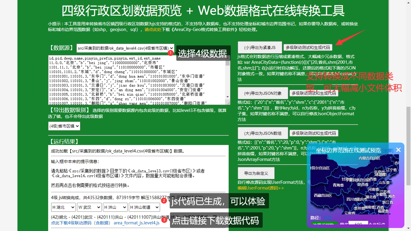
【END】