Agisoft Metashape creates 3D models from satellite imagery
Article directory
foreword
Agisoft Metashape Professional supports processing stereo satellite images with RPC parameters. Supported satellite data are: Beijing-3A, Ikonos, Planet Labs, Pleiades, SuperView, Jilin, WorldView.
RPC parameters can be loaded from rpc.txt, .rpb or DIMAP .xml files (single slices only) and from the RPC coefficients tag of TIFF image metadata.
1. Add images
-
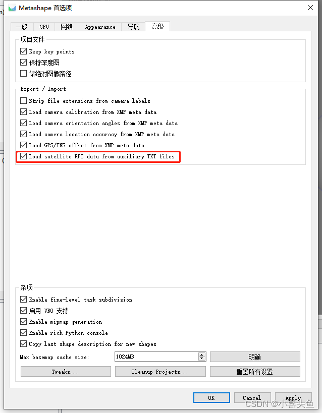
Before adding satellite imagery to your project, make sure to enable the "Load satellite RPC data from auxiliary TXT file" option in the Preferences dialog. To do this, select the "Preferences..." command from the "Tools" menu, switch to the "Advanced" tab, and turn on the "Load satellite RPC data from secondary TXT file" option.
-
Select the "Add Photo..." command from the "Workflow" menu to add the image to the