The latest road vector data in July 2023 (nationwide/province/city)
Road data is something we use frequently in various studies! Although road data is very commonly used, there are basically no websites that can download road data in recent years, so many people do not know how to obtain road data. The website we recommend this time for downloading road data is Open Street Map! Let’s first learn about Open Street Map, referred to as OSM, which is an open source map data community. Global contributors contribute map data to the project. Through the OSM map, the data that can be downloaded includes roads, water systems, buildings, etc.
This time we have compiled road data across the country (including Hong Kong, Macao and Taiwan), and the download time is July 2023! And split according to provinces and cities! So the data includes:
o Nationwide road data
o Road data for each of the 34 provinces across the country
o Road data for each of the 371 prefecture-level cities across the country
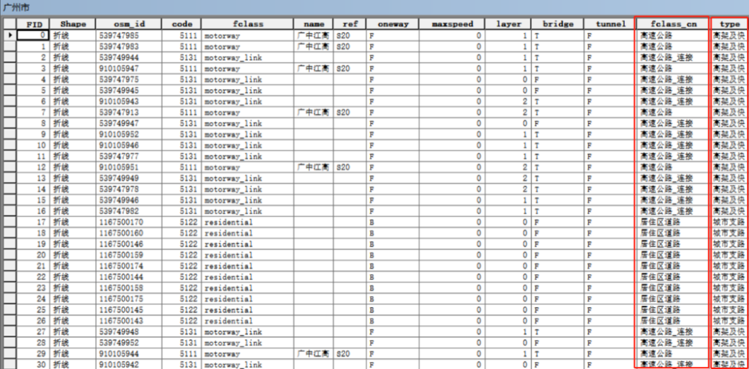
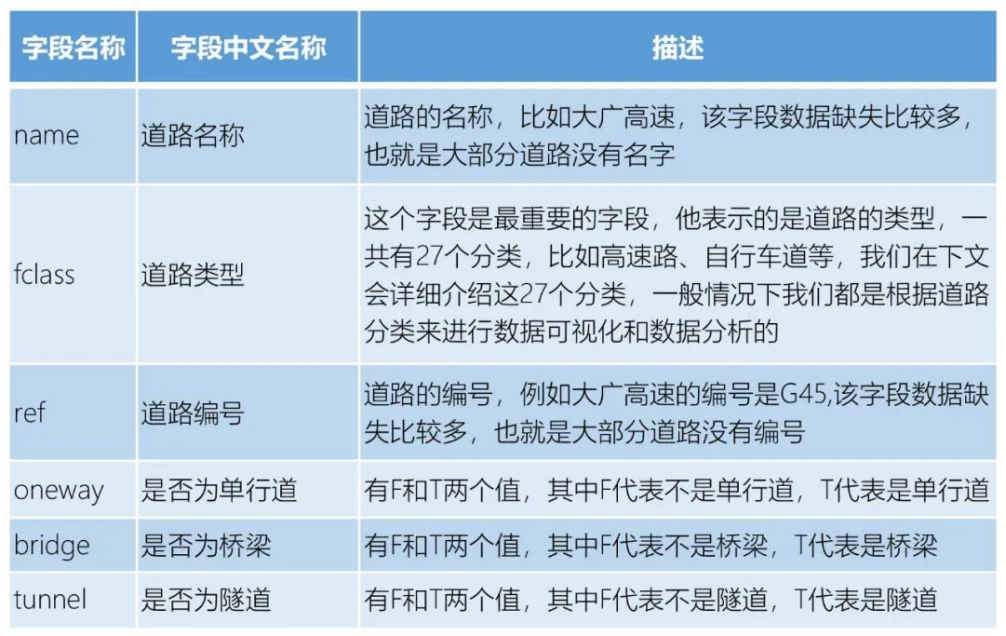
In addition, in order to make it easier for everyone to use this data, we have added two new columns based on the original data. One column is the Chinese translation of the most important "road type" field in the data, and the other column is based on our commonly used road classification standards. The road type that the road belongs to.
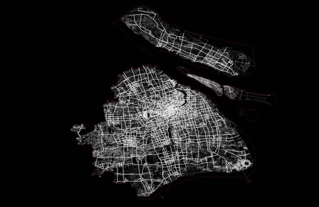
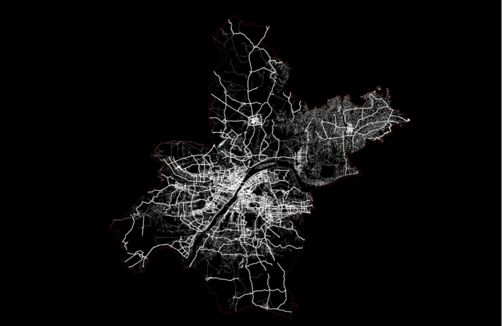
Let’s take the three cities of Shanghai, Wuhan and Guangzhou as examples to preview the data:
Shanghai
Wuhan
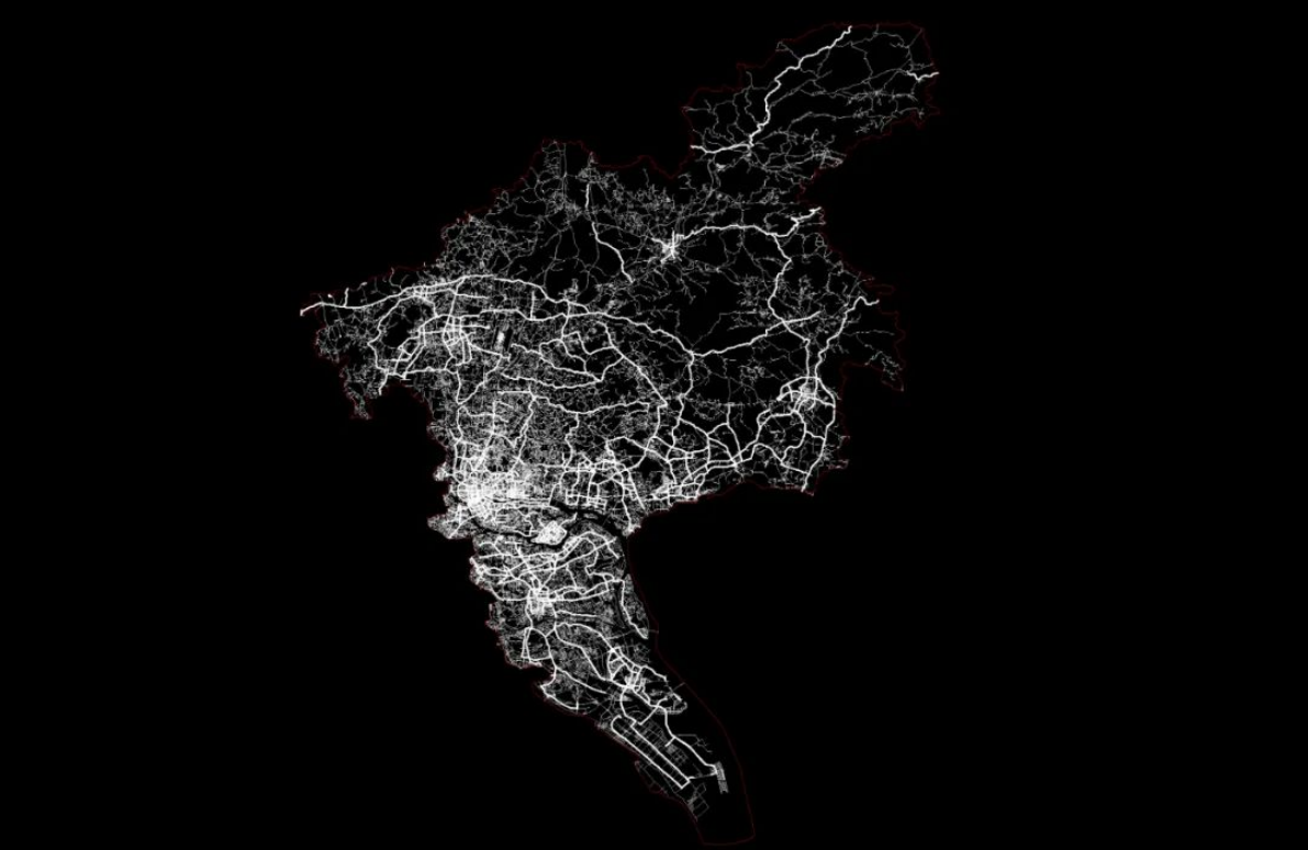
Guangzhou City
Data details introduction
Let’s introduce the road data of OSM map in detail. The data format is shp format, the coordinates are wgs1984, and the data fields include:
Let's take a look at the road types that everyone is more concerned about. The roads downloaded from the OSM map have 27 categories. The road types are stored in the "fclass" field. Many people must be confused when they see so many categories, but this Need to figure it out again! Understanding the road type is the basis for us to do a lot of work using road data. For example, when we use road data, we often need to estimate the driving speed of the road, and this speed is generally based on the road type. For example, the speed of the elevated road must be Much faster than city branch roads! The 27 classifications of OSM map roads are as follows:
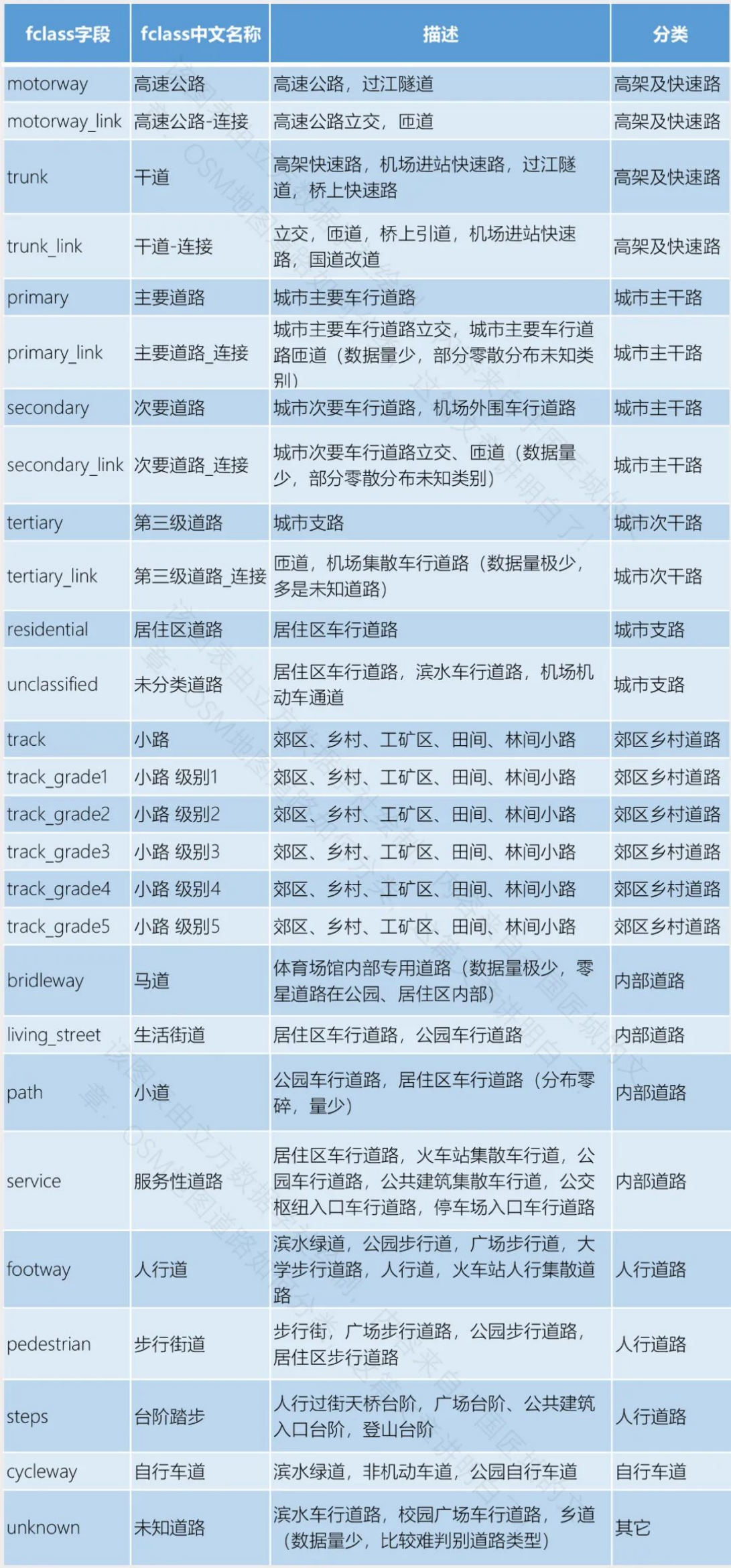
What needs to be added is: the last column of the table is the road classification. This classification is not the classification provided in the OSM map. It is divided by Guojiangcheng itself based on experience. First of all, this work is very necessary, because the classification of roads we use normally is based on the system including urban expressways, urban trunk roads, and urban secondary trunk roads. Everyone should be more familiar with this classification system, but the roads on the OSM map The classification is not entirely based on this, so it is very necessary to reclassify it; secondly, you can also adjust this classification according to your own research needs or experience!
Data download process
If you want to download the data yourself, you can download it according to the following process. It should be noted that you need to access the Internet scientifically before you can open the website below to download the data! Downloading is divided into two situations. The first is to download data in a small area, such as downloading data in a block, and the second is to download data in the entire China. Let’s look at the first one first:
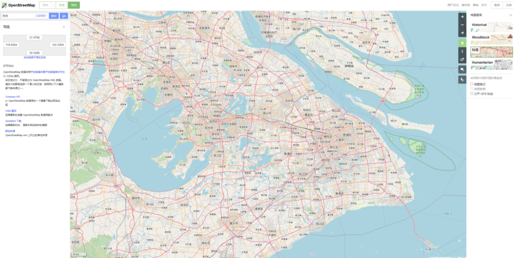
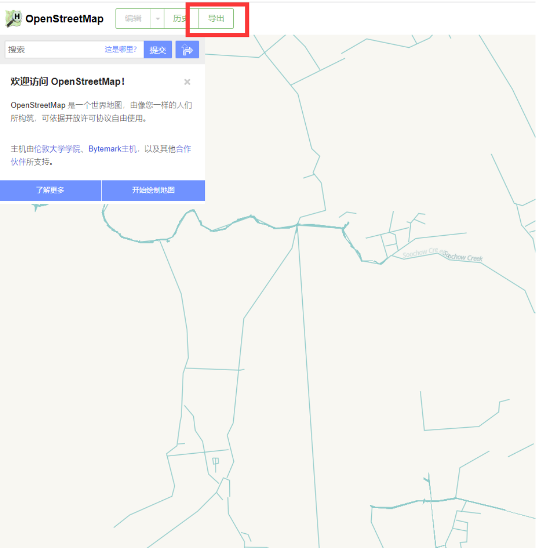
①Open the OSM map website (https://www.openstreetmap.org/) and click the "Export" button
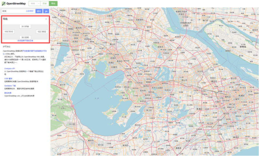
② Fill in the longitude and latitude range, or manually select the range, and then click the "Export" button to download the data.
③The downloaded data is in osm format. If you want to convert it to the commonly used shp format, you need to perform corresponding operations. Here we will post an article for you, which contains three methods of converting from osm format to shp format. We put the article at the end of the article to "read the original text"! Let's take a look at how to download nationwide data: ① Start by opening the OSM map website, then click the "Export" button, and then click "Geofabrik Download".
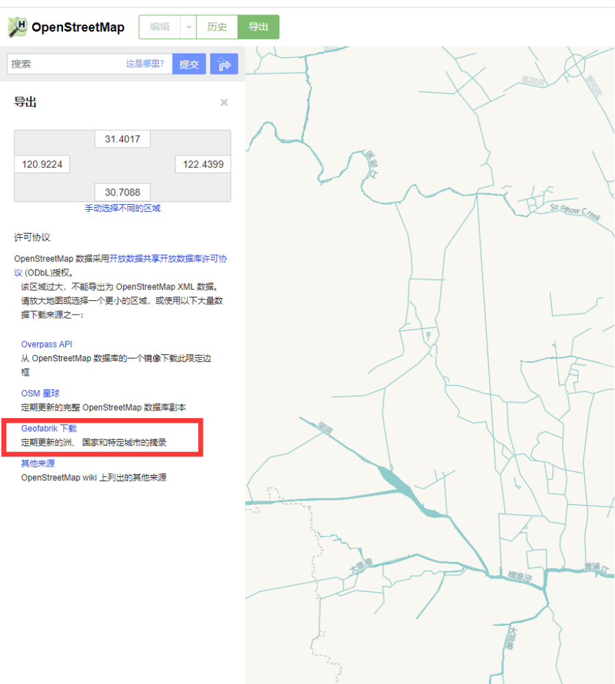
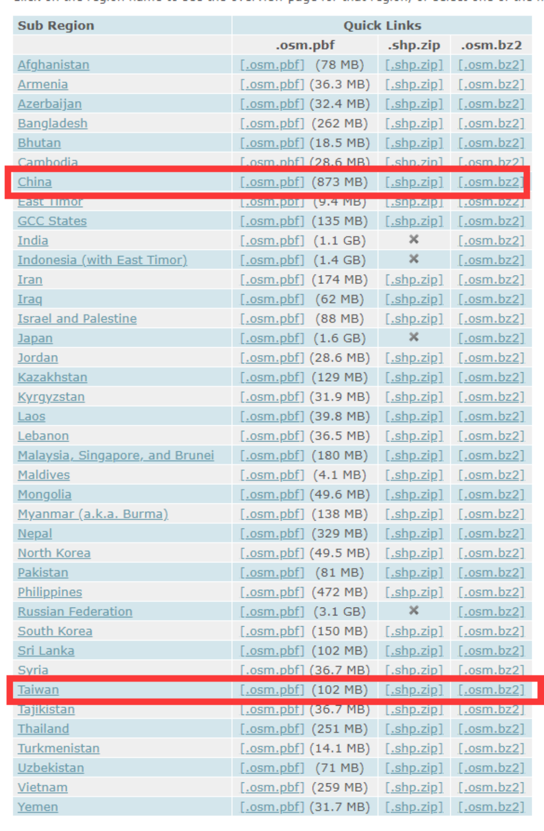
② After entering, click on Asia, and then find china and t. This we must solemnly emphasize that Taiwan Province is an inalienable part of China! After downloading, we need to piece together the data from mainland China and Taiwan to form a complete nationwide data. When downloading here, you can download it directly in shp format, which saves you the trouble of format conversion! Then if you don’t circumvent the wall, the download will be very slow!
the data shows
1. The data of the OSM map is open data, and the accuracy of the data is not strictly scientific. When using the data, everyone can make their own judgment based on their personal circumstances;
2. If you want to write the data source, just write the Open Street Map directly.
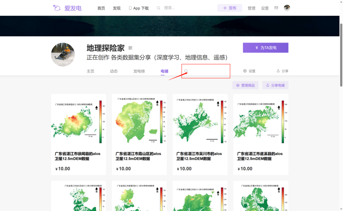
Data acquisition: https://afdian.net/a/DLTXJ?tab=shop
Search for keywords in the search bar