Table of contents
introduction
By the way, drones are really hot right now. Various industries are using drones to develop some business scenarios, such as agricultural fertilization and spraying, regional environmental monitoring, urban emergency dispatch, and remote inspection of power station equipment, etc. Because it can be loaded with video surveillance, it can remotely transmit video images to monitor the status quo of equipment and the environment. The small drone solves a lot of remote work and repetitive work, which can be said to be a great help to humans.
In contrast, the intelligentization of UAV equipment has improved, and the demand for background data monitoring and management has also followed.
demand background
A while ago, a friend who manages energy power stations said that they are also using drones to do some inspections of substations, but because of the large number of substations and scattered sites, they want to build a monitoring and management platform for transportation and prevention. This allows for centralized control.
I am quite interested in this scenario. In fact, the UAV inspection program mainly includes several parts such as UAV equipment, sensors, flight planning system, and background data analysis and management.
- First of all, it is necessary to collect basic data of UAV equipment and related sensor equipment, which can be controlled remotely.
- Then, carry out flight planning, determine the flight path of the UAV, and the UAV will fly according to the planned path, and collect these dynamic data through sensors;
- The common one is to process and analyze the collected data, mainly including the analysis and management of data such as equipment and abnormal conditions;
- More advanced ones can use AI to do intelligent video analysis and identification, such as some abnormal situations in substations, which can be automatically discovered. However, most of these rely on AI algorithms for modeling and algorithm optimization.
A friend said that their drones are currently controlled by personnel on site, and usually need to fly around the surrounding area multiple times according to the situation of the power station, so it is difficult to plan the flight path in advance. That is to say, these functions of intelligent path planning are not required.
From this point of view, in fact, the requirements are not very complicated. Basically, it is equipment data connection, remote collection and transmission, data statistical analysis, flight mission management and inspection management, etc.
Because I happen to be researching some low-code and no-code development platforms, among which smardaten seems to have a relatively complete functional system. I have done some single-point trials before, and I just took this opportunity to practice my hands.
Of course, I also found their product technical support in the middle, and quickly made a rough idea. This time the overall system environment is changed to a dark color system.
Limited to the permission of some actual equipment and environment, some functions are relatively simple, let's see how the effect is.
build ideas
After quickly connecting the UAV and power plant equipment, pre-set the inspection task plan and flight time on the remote terminal, you can view the inspection route and inspection video playback on the system, and know the power station equipment and environment without on-site operation Status, and the ability to automatically upload data and analyze applications.
The overall configuration process of this system generally includes 6 stages:
1. Connecting drones and some control equipment
2. Some data management for inspection tasks and processes
3. Large screen for integrated transportation and defense data
4. Alarm management for daily inspections
5. Multi-dimensional monitoring of UAV prevention and control
6. Basic information maintenance
development process
(1) UAV equipment data access
The devices that need to be connected include: drones, controllers, machine nests and other devices.
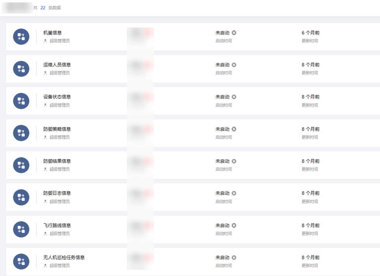
Through the platform IoT protocol, all devices are configured through the protocol interface, and data processing and collected data storage are configured according to requirements. Support adding, setting and parameter management, station ID, anti-device connection and information management.
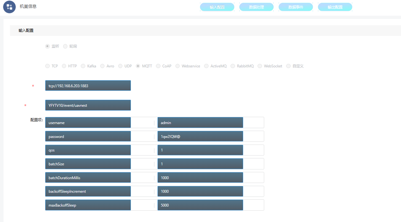
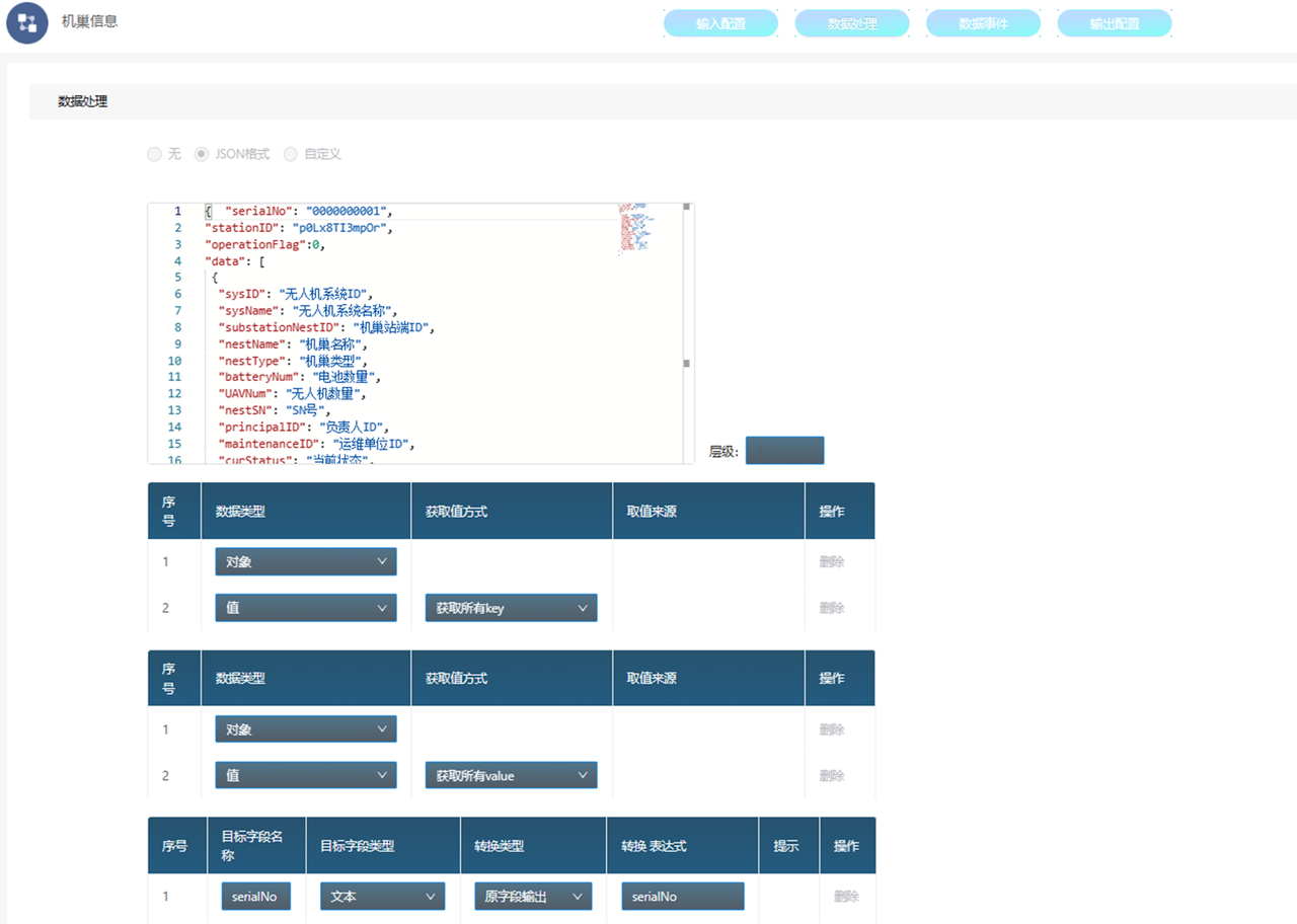
For the collected data, the field type and acquisition method can be configured in detail according to the field.
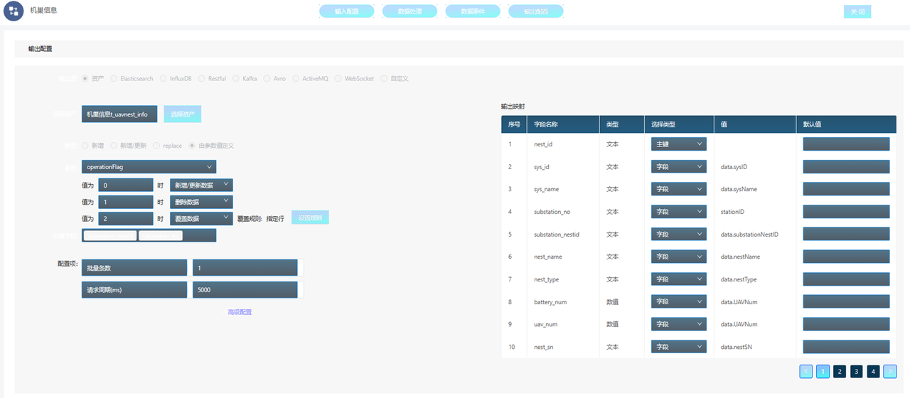
Configure the path address of the data output. Here you can set the value of the data rule. For example, the value exceeding the rule can be deleted, and the request cycle can be set.
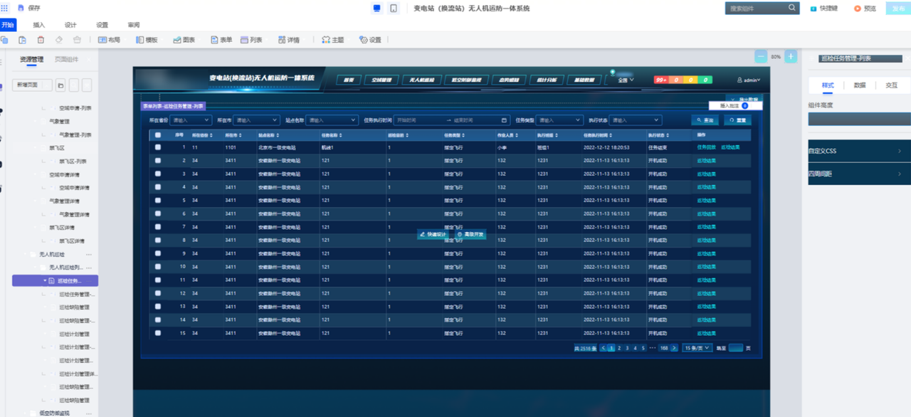
(2) UAV inspection task management
To maintain and manage the situation of using UAV flight inspections, managers can add inspection plans, such as inspection site names, task names, task types, operators, flight time, etc. Aircraft and real-scene simulation flight, you can view the defense map, improve the efficiency of inspection management.
Configure variables for the current inspection task data, which is equivalent to dynamically associating and matching with other module data.
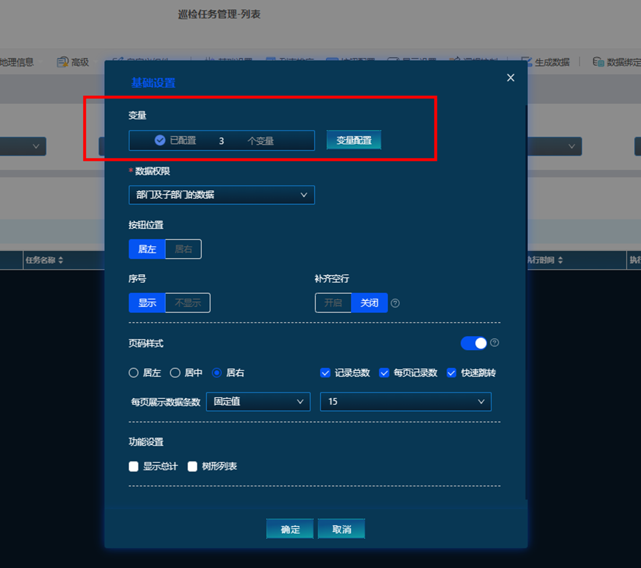
Multiple variables can be added, including provinces, cities, and site names.

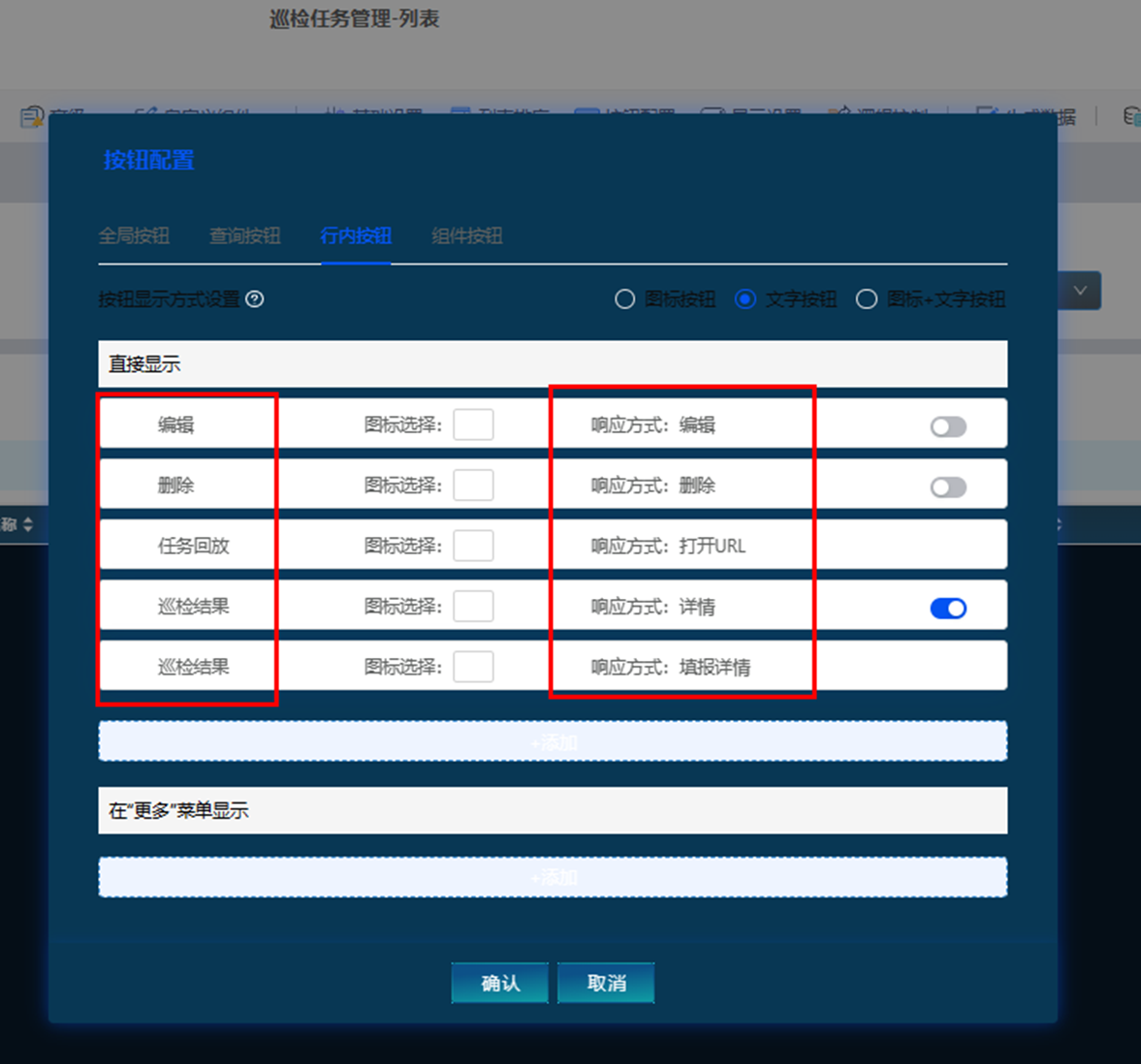
Add an in-line button to the list page, take task playback as an example, and jump to the drone inspection recording video.
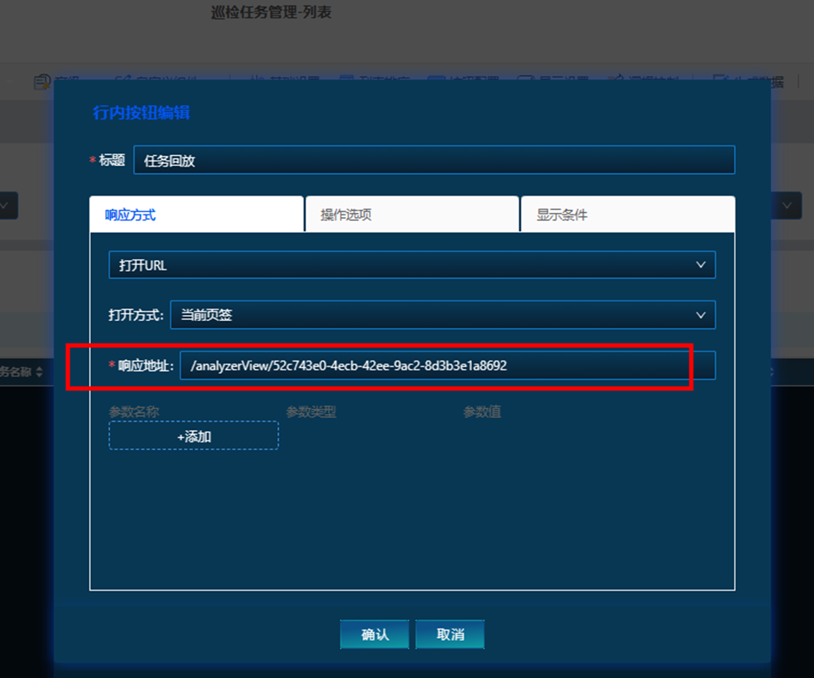
The response address is to connect the UAV device and its corresponding video address in advance.
The style of the page after the inspection task is completed. The filling action of some forms is carried out on the mobile terminal, and the PC terminal is used for viewing and management.
(3) UAV three-dimensional prevention and control surveillance
The requirements for 3D real-time flight monitoring are relatively high, which requires relatively high model quality and data transmission. In the 3D scene, it is possible to monitor the flight of the UAV system in the target area, replay the flight record, view the route, retrieve the video, and monitor and manage the intruding UAV.
The platform itself does not support the development of 3D models. If there is a model, it can be directly imported for linkage interaction. Here we temporarily refer to ordinary 3D models to make a simple interactive scene. You can view drone flight records, including latitude and longitude, altitude, flight time, etc.
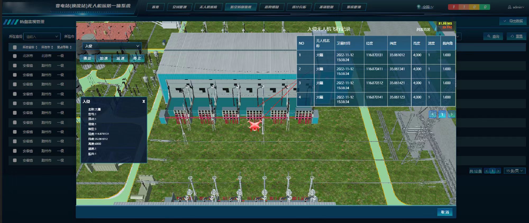
However, some personalized interactive actions such as flight actions, acceleration and deceleration, and aircraft recording video need to be configured and developed on the smardaten digital twin advanced platform, and most interactive scenarios do not require code. Here I briefly tried some code secondary development for the time being.
(4) Integrated large screen design for transportation and defense
Perform visual analysis and display of the regional transportation and defense situation of each station within the jurisdiction, monitor key data in real time, locate early warning information and view detailed data. A common large-screen layout was chosen, with a map in the middle, and key monitoring data for linkage analysis and display.

You can import target data chart types, such as commonly used indicator cards, graphs, and lists, and you can display them if they match the target business data. Complicated data charts can also be completed through the data analyzer, after configuring styles and variables, and then uniformly import them into the large screen.

(5) Abnormal alarm management
Alarm management is relatively common in many scenarios. Alert the abnormal situation of the flight inspection, and locate it on the spatial map, and display the warning site, warning items, personnel information, etc.
The alarm information is mainly displayed by the abnormal data automatically collected by the device, so you only need to configure the alarm-related fields to be viewed and the corresponding detail page.
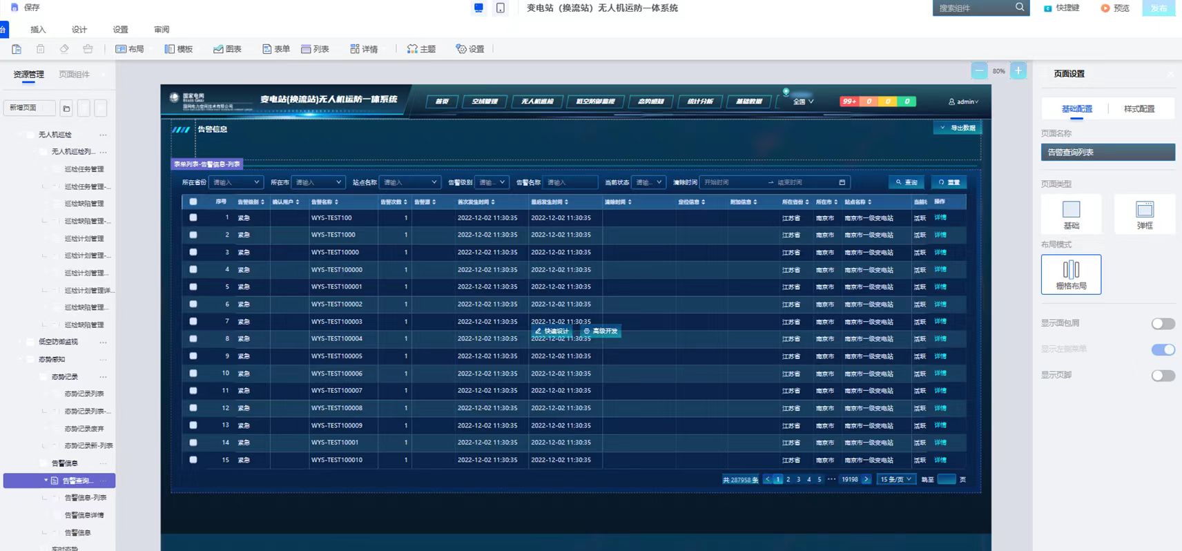
All the fields that have configured the alarm information list are already on the left, and can be directly dragged to the canvas for layout, without the need to select components again or re-bind data assets.

(6) Basic information maintenance
Unified maintenance and management of basic information such as substation sites, anti-unmanned equipment, drone controllers, airspace applications, no-fly zone management, and inspection personnel. It is mainly the configuration of forms, lists and details, and the process methods are basically the same.
The following takes the UAV controller form and detail configuration as an example.
① All the fields that need to be filled are laid out side by side in 2 columns, among which information such as the operation and maintenance unit, person in charge, and whether there is no response can be quickly selected through the drop-down box component.

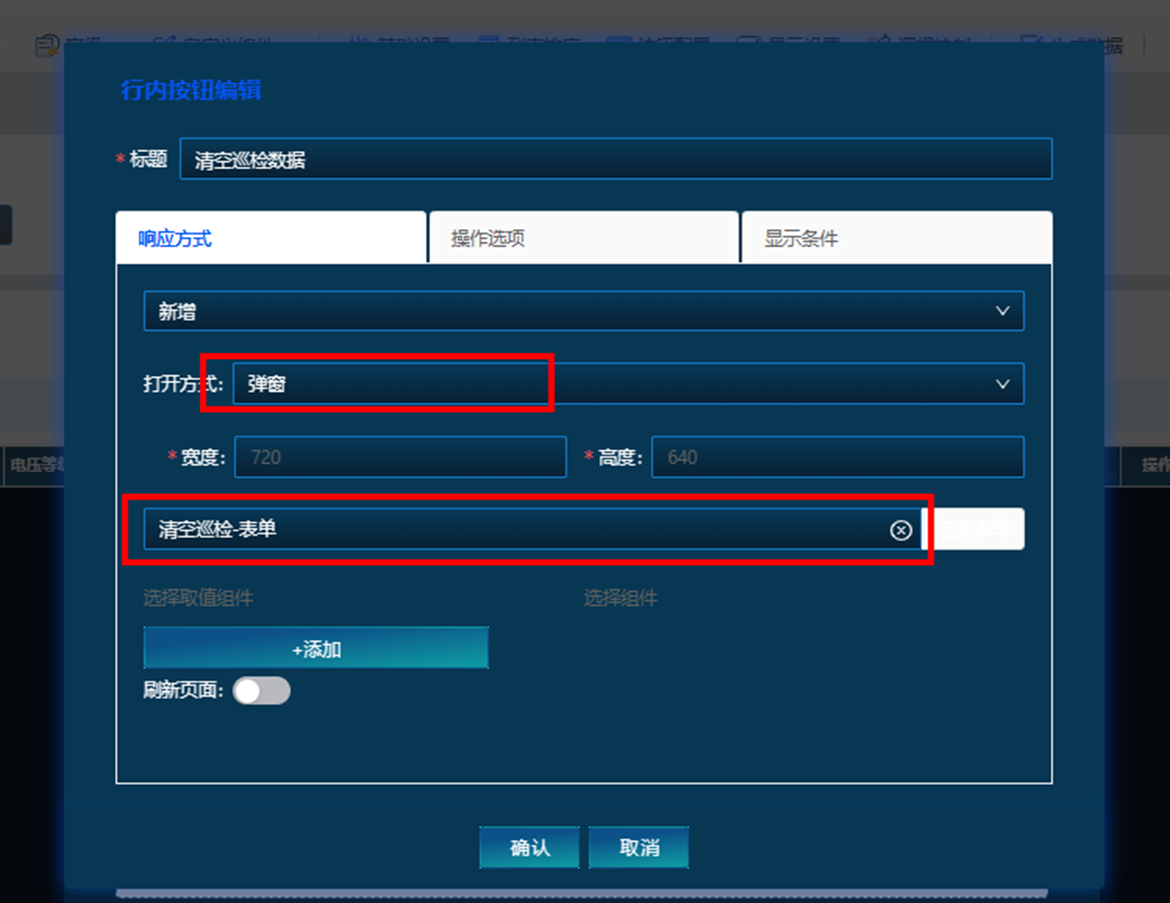
② After the controller device is completed, it needs to be submitted for review, add a custom button, and configure the button action.
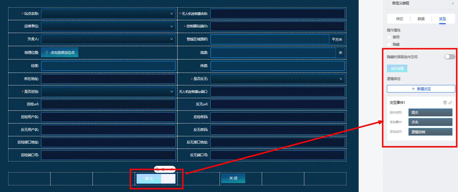
At the same time, add several inline buttons on the list page. The buttons can be edit, delete, popup, link jump, add data, etc., and corresponding icons can also be added.
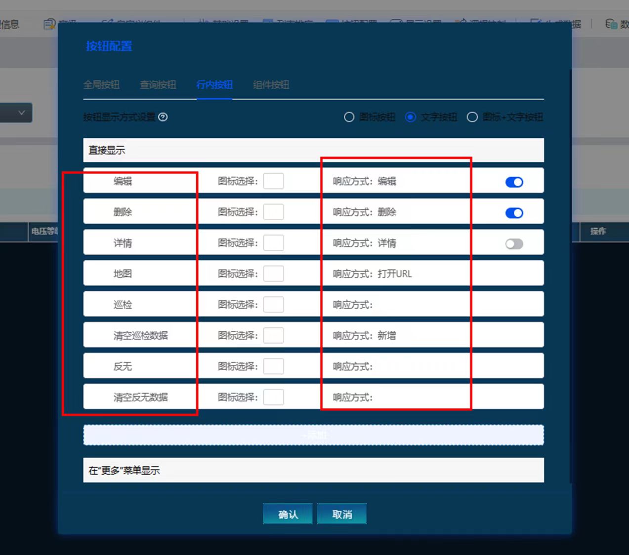
Buttons can choose different response methods, including editing, pop-up window, opening URL link, opening new form, etc. More complex interaction logic can also be configured through logic control.
In the same way, configure the UAV device management page, including the corresponding site name, corresponding controller device name, controller ID and other information.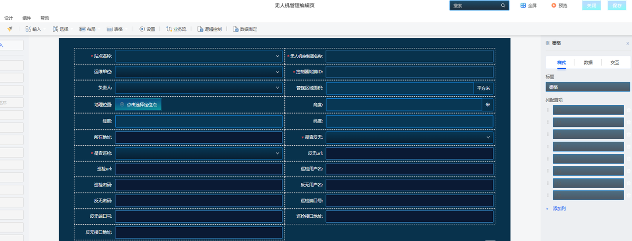
Summarize
Although the UAV transportation and defense management platform made this time is relatively rough, it did not spend too much energy after all. If you find a few more people to do development and configuration, you should be able to do a good job, and you can refine some styles. But after a while of operation, it can be seen that the no-code development platform is no longer the simple drag and drop to build forms, processes, and simple diagrams that were originally understood.
For example, smardaten, as an enterprise-level no-code platform, has extended to the underlying data integration, data management, and advanced data analysis display, and provides many complex components on seemingly ordinary forms and page layouts, which can realize more complex Interactive choreography. Different low-code and no-code may have different focuses, but they have indeed been sinking into the industry scene and have stronger applicability. You can go to the smardaten official website to try the online version.
However, the complexity of the functions means that there is a certain degree of difficulty in learning, and a certain code foundation and cognition are still required. With more and more practices of no-code development, perhaps in the near future, those complex configuration processes can be further simplified. Even AIGC technology can be used to implement simple page generation or development action guidance through algorithm models, and the development interaction experience will be even better.