Using the map positioning plugin of vue2
https://dafrok.github.io/vue-baidu-map/#/zh/control/city-list
1. First of all, it must be downloaded first.
npm i vue-baidu-map -S2. After downloading, remember to import it globally, in the main.js file
import BaiduMap from 'vue-baidu-map'
Vue.use(BaiduMap, {
// ak 是在百度地图开发者平台申请的密钥 详见 http://lbsyun.baidu.com/apiconsole/key */
ak: 'YOUR_APP_KEY'
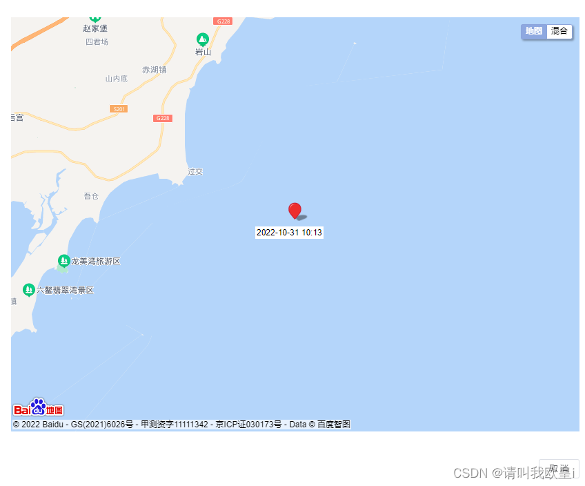
})3. Start to use, what I am doing here is to display the positioning pop-up window of each row of the table data. When the positioning of the current row is clicked, a pop-up window will pop up to display the map positioning point. The positioning point is dynamically jumping. The code is as follows, click as follows small icon to open map
![]()
<el-table-column label="定位">
              <template slot-scope="scope">
                <i
                  class="el-icon-location hostlocation"
                  @click="positioning(scope.row)"
                ></i>
              </template>
            </el-table-column>
// 项圈定位打开弹窗
positioning(row) {
this.sign = true
this.dialogMap = true
//时间
this.time = row.distribute_time
//经度和纬度
this.center.lng = parseInt(row.longitude)
this.center.lat = parseInt(row.latitude)
},Fields must be defined first in data
 dialogMap: false,//控制弹窗
      time: '',//定位点下的时间
      center: { lng: 0, lat: 0 }, //坐标
      zoom: 14,//缩放
      sign: false//弹窗开关
Pop-up content
 <el-dialog
        title="项圈定位"
        :visible.sync="dialogMap"
        width="45%"
        :closeOnClickModal="false"
        :showClose="false"
        :destroy-on-close="true"
        v-if="sign"
      >
        <div class="location-box">
          <template>
            <!-- :scroll-wheel-zoom="true":开启滚轮缩放,center:"{lng: 116.404, lat: 39.915}",格式如下,定义地图经纬度 -->
            <baidu-map
              style="height: 600px"
              class="map"
              :zoom="12"
              :center="center"
              :scroll-wheel-zoom="true"
            >
              <!-- BMAP_NORMAL_MAP:展示图片街道视图, BMAP_HYBRID_MAP:卫星和路网的混合视图-->
              <bm-map-type
                :map-types="['BMAP_NORMAL_MAP', 'BMAP_HYBRID_MAP']"
              ></bm-map-type>
              <!-- BMAP_ANIMATION_BOUNCE:定位点跳动 -->
              <bm-marker
                :position="center"
                :dragging="true"
                animation="BMAP_ANIMATION_BOUNCE"
              >
              <!-- 时间文本 -->
                <bm-label
                  :content="time"
                  :labelStyle="{
                    color: 'black',
                    fontSize: '12px',
                    borderColor: '#fff',
                    borderRadius: 10
                  }"
                  :offset="{ width: -48, height: 28 }"
                />
              </bm-marker>
            </baidu-map>
          </template>
        </div>
        <span slot="footer" class="dialog-footer">
          <el-button @click="cancel" size="mini">取 消</el-button>
        </span>
      </el-dialog>
Finally, as shown in the figure, you can switch the satellite image
Hope to help you~