1. Product overview
Shui Jing and Shui Jing Zhuo respectively originate from the ancient Chinese geographical masterpieces "Shui Jing" and "Shui Jing Zhu". "Shui Jing Zhu" has a total of forty volumes. The author is Li Daoyuan in the late Northern Wei Dynasty. It is named after the annotation "Shui Jing". "The Classic of Water" has about 10,000 words, and "Liu Dian of Tang Dynasty" said that it "leads the water of the world, one hundred and thirty-seven". "Shui Jing Zhu" seems to be an annotation of "Shui Jing", but it is actually based on "Shui Jing". It records in detail more than 1,000 large and small rivers and related historical relics, personal stories, myths and legends, etc. It is the most famous ancient Chinese classic. The most comprehensive and systematic comprehensive geographical work. The book also records a lot of inscriptions on steles and folk songs of fishermen. "Shui Jing Zhu" was selected as China's first monograph on hydrology and geography by the China World Record Association, which is another Chinese best in ancient Chinese hydrology and geography. "Shui Jing Zhu" is a book of more than 300,000 words, which introduces in detail more than 1,000 rivers in my country and the counties, cities, products, customs, legends, and history related to these rivers. "Shui Jing Zhu" is strong and handsome in writing. It is not only an ancient geographical masterpiece, but also an excellent work of landscape literature. It is a geographical work with literary value.

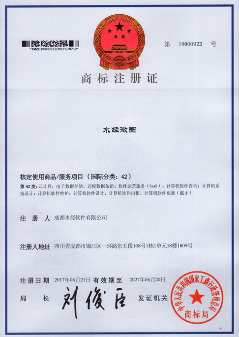
Here, "Shuijing Note Software" and "Shuijing Software" both belong to the software brands of "Chengdu Shuijing Software Co., Ltd." (formerly known as "Chengdu Shuijing Note Information Technology Co., Ltd."). At present, the company's core products are "Shui Jing Micro Map" (referred to as "Micro Map") and "Shui Jing Note Universal Map Downloader" (referred to as "Universal Map Downloader"), of which "Shui Jing Note Universal Map Downloader" was created in May 2006. "Google Satellite Map Downloader" released on the 19th is the technological crystallization of the continuous upgrading and evolution, and "Shuijing Micro Map" is based on all the functions of "Shuijing Note Universal Map Downloader", adding professional It has powerful functions such as GIS mapping, CAD mapping, photo management and data synchronization, and has the trademark of "Water Jingwei Map".
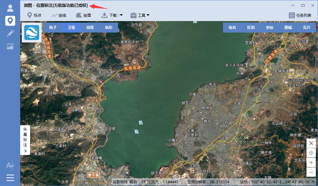
The dongle of the universal map downloader can authorize all the functions of the universal map downloader in the micromap. After inserting the dongle and starting the waterway micromap, a successful authorization prompt of "universal version function has been authorized" will be displayed.
To sum up, "Shui Jing Micro Map" is a geographic information cloud product with more than ten years of product experience, profound cultural connotation and a broad user base in the GIS industry. It is designed for archaeology, electricity, water conservancy, communication, logistics, petroleum, land, agriculture, forestry, environmental protection, environmental impact assessment, mining, ocean, geophysical exploration, planning and design, digital city, digital urban management, comprehensive emergency, intelligent transportation, public health, gardening Users in industries such as design, environmental monitoring, road surveys, ground disaster investigations, real estate, earthquakes, fire protection, public security, commerce, gas, drainage, advertising, insurance, and education provide a stable operation, feature-rich, concise interface, simple operation, A professional and easy-to-use GIS product that can synchronize data cloud with the mobile terminal.
2. Function introduction
"Shui Jing Micro Map" is rich in functions. It can download all online maps published in tiles and perform large map splicing, map reprojection, tile re-slicing, map annotation, vector download, vector overlay, CAD drawing, and professional GIS drawing. , photo management and data cloud synchronization, etc., and includes all the functions of "Shui Jing Zhu Universal Map Downloader".
Speaking carefully, the most important functions mainly include CAD drawing, professional GIS map drawing, photo management, cloud synchronization of vector data, cloud synchronization of photos, high-definition satellite image download, image shooting date viewing, high-definition historical image download, and original elevation data download. , elevation contour extraction, vector point of interest (POI) download, global vector road network download, national building outline download, image vector projection conversion, export unlimited large images (can be exported in blocks), export tiles (reprojectable) ), export map offline package, vector point labeling, vector path drawing, vector surface outline drawing, national standard sub-frame map download, instant download results, topographic and landform rendering map download, 10-meter contour raster map download, Rich and diverse map resources, online viewing of virtual 3D terrain, perfect overlay of vector data and images in CAD, perfect overlay of vector data and images in ArcMap, support for image data cropping and background transparency, support for elevation data cropping and background transparency, etc. The functions will be explained as follows:
1. Cloud synchronization location annotation
This function is suitable for ordinary individual users to mark the travel location on the mobile phone and synchronize it to the cloud, which can leave traces of your life wherever you go.
On the PC side of Weitu, the location annotation can be synchronized to the cloud, and the cloud data can also be synchronized to the PC of Weitu for addition, deletion and modification.
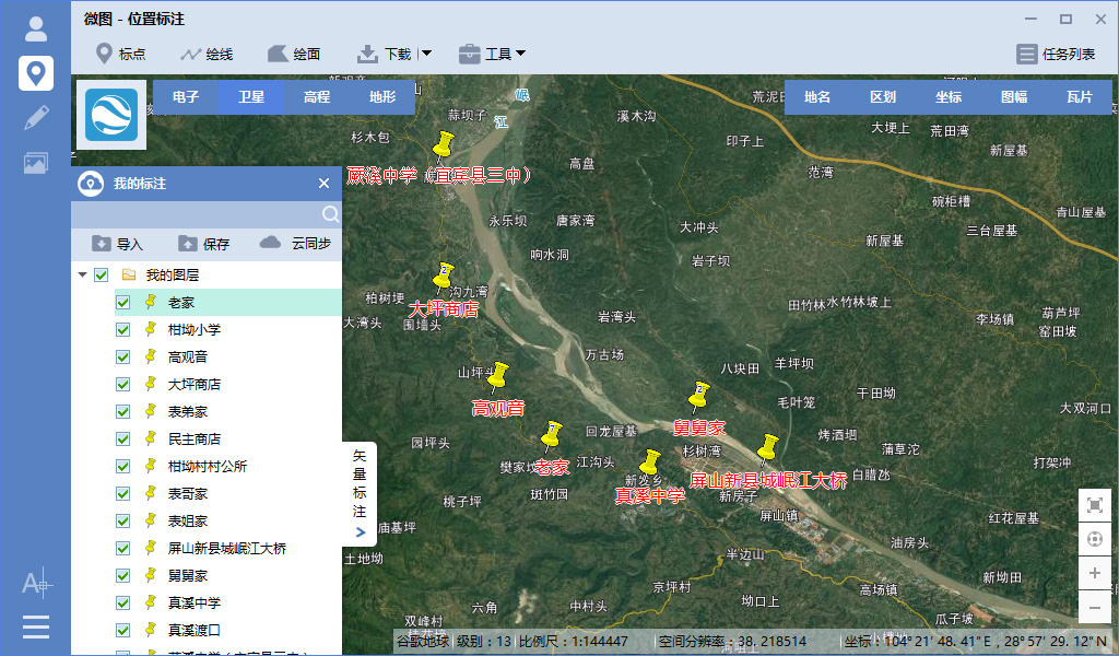
In the Weitu APP mobile terminal, the location annotations marked on the mobile phone can be synchronized to the cloud, and the cloud data can be synchronized to the Weitu APP mobile terminal for addition, deletion and modification.

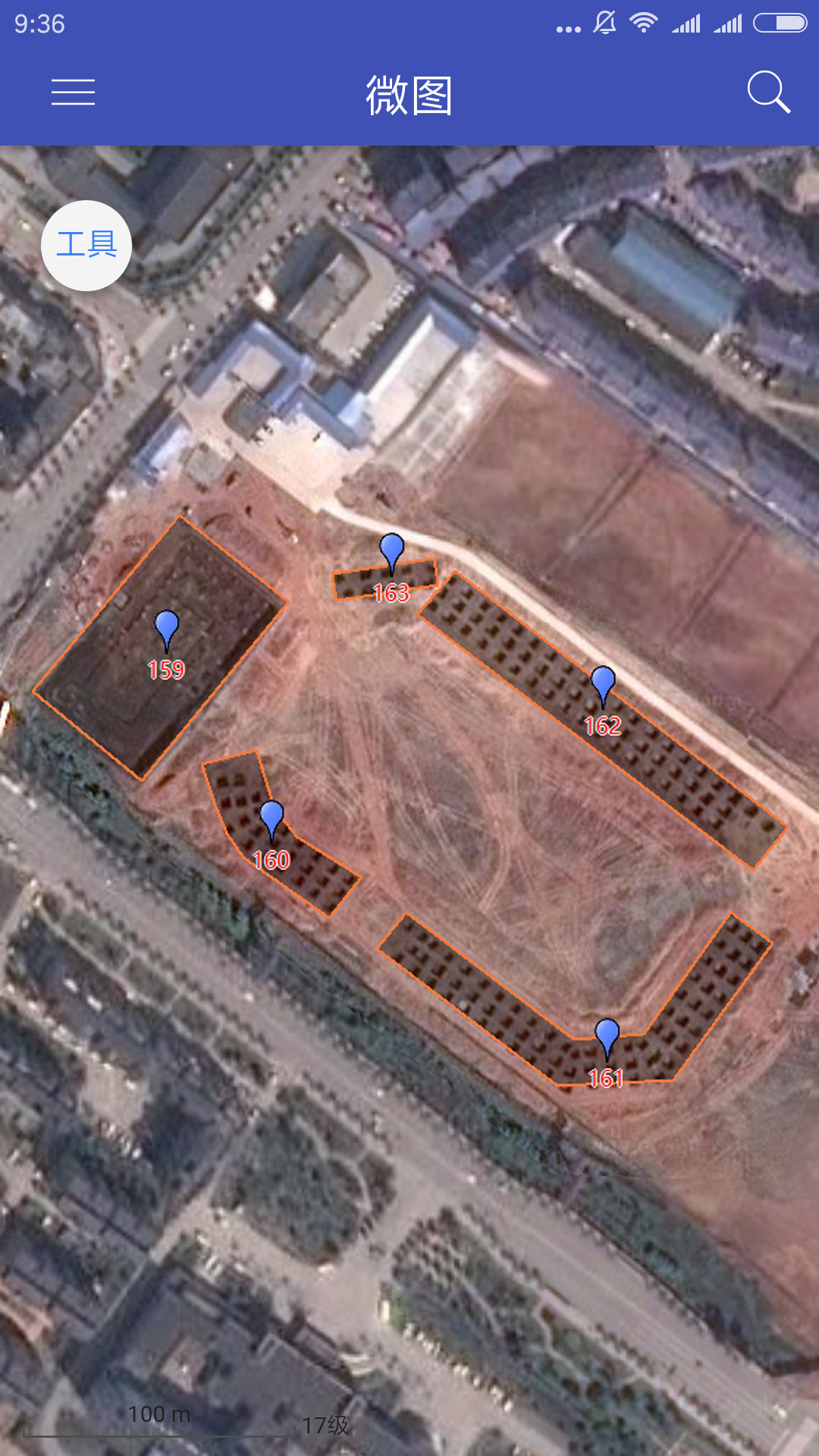
2.云同步GIS地图数据
在微图PC端中,可以将绘制的专业GIS地图数据同步到云,也可以将云中的数据同步到本地进行添加、删除和修改。
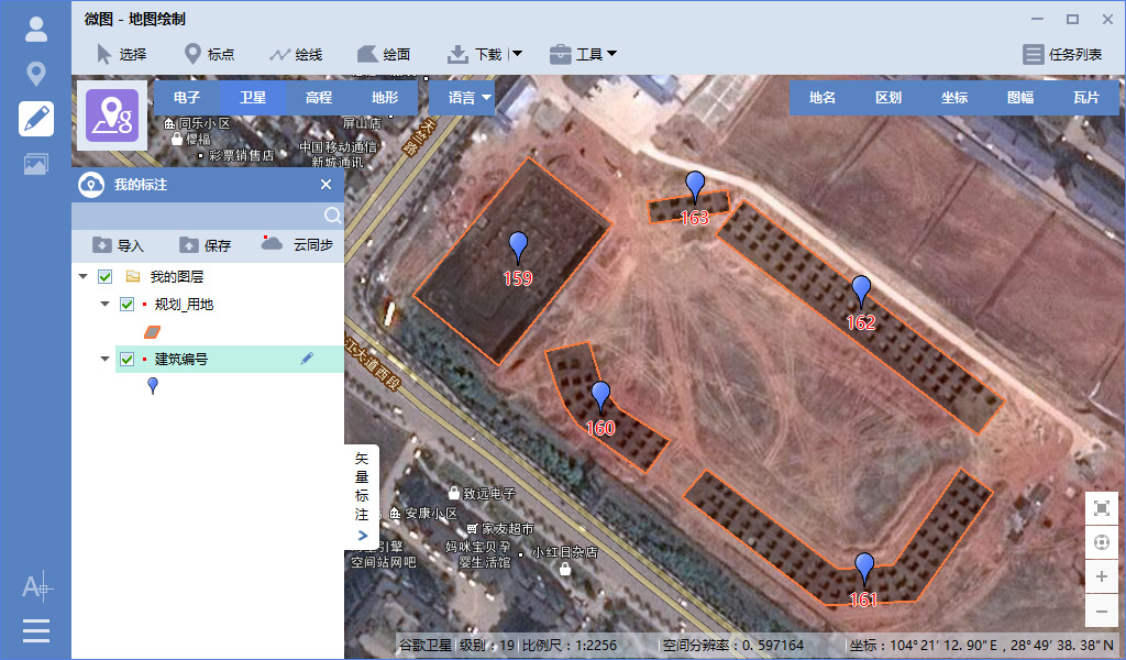
在微图APP中,可以将云中的专业GIS地图数据同步到手机端,进行添加、删除和修改之后,可以再将结果同步到云。
3.云同步照片
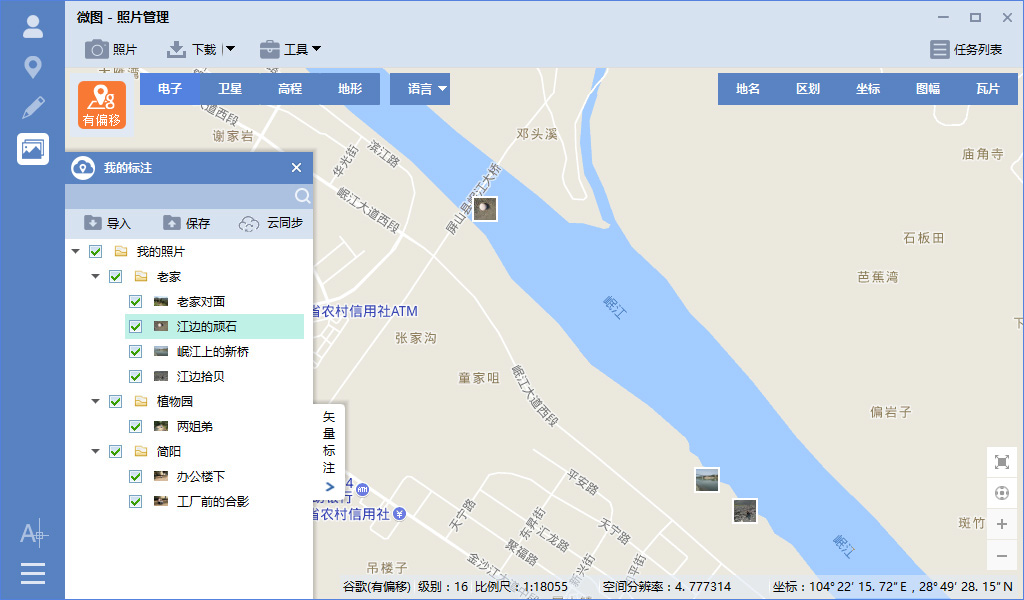
微图提供照片管理功能,在微图PC端可以将旅游照片、电力巡线、基站设备故障等照片从云服务器同步到本地。
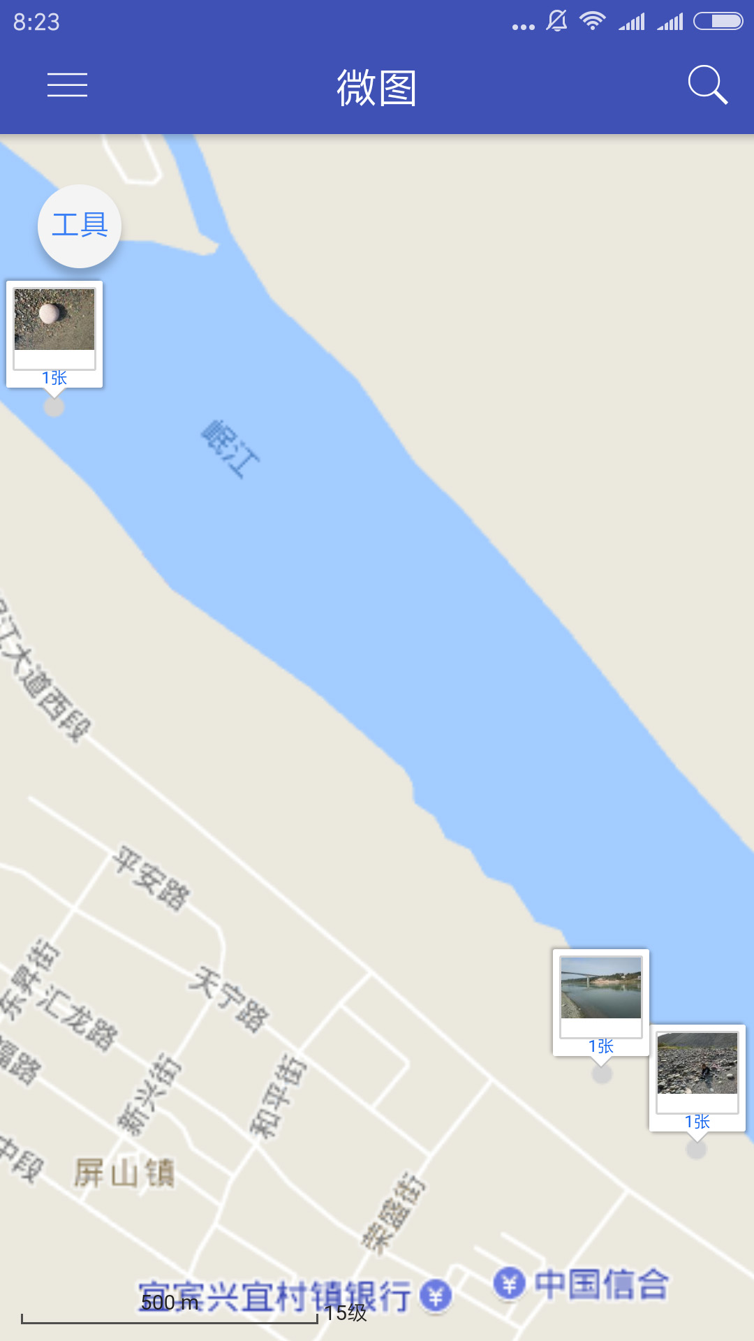
在微图APP端,可以将拍摄的旅游照片、电力巡线、基站设备故障等照片同步到云。
4.CAD制图
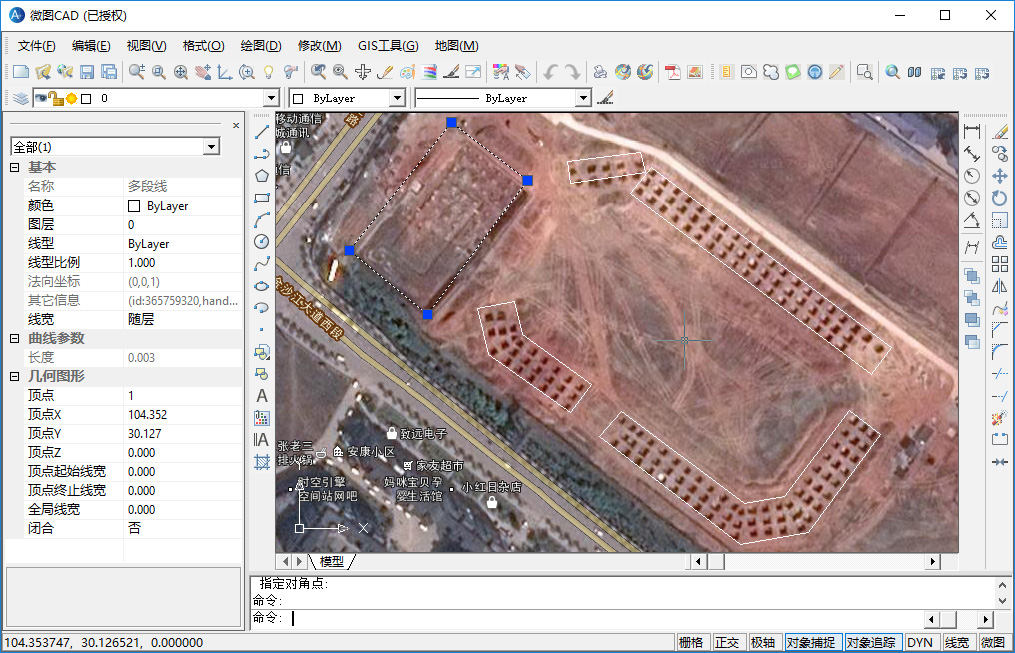
在微图PC端点击“CAD绘制”功能,可以启动微图CAD制图工具。
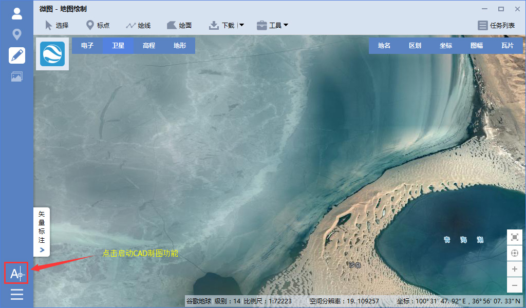
在微图CAD中,可以在线加载全球的谷歌卫星地图,解决了传统CAD中加载大图卡顿或因图片太大无法加载的问题。
5.高清卫星影像下载
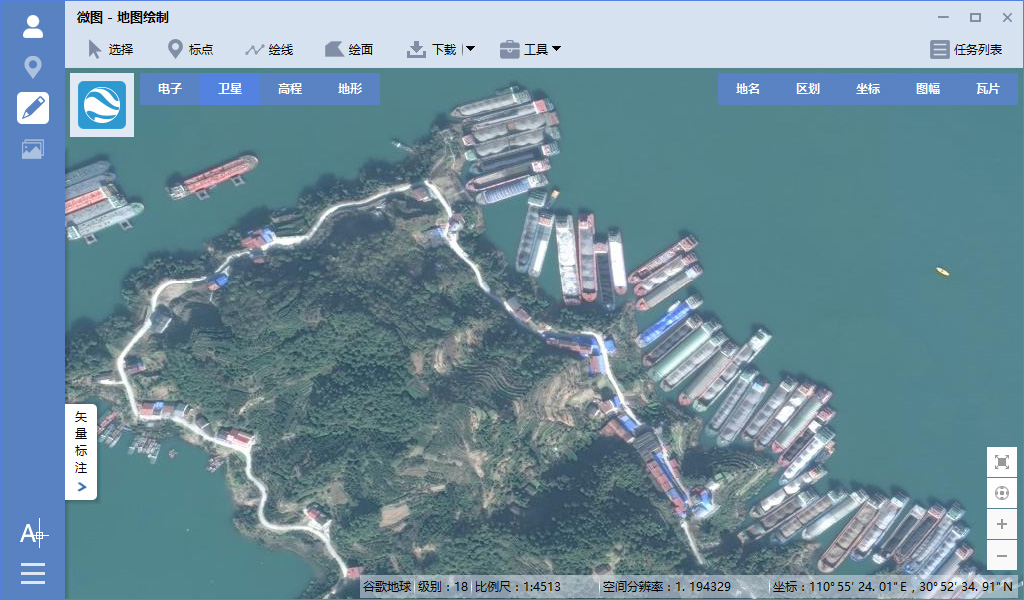
影像最高分辨率可达0.25米,边江上的船舶都能看得非常清楚,效果如下图所示。
6.影像拍摄日期查看
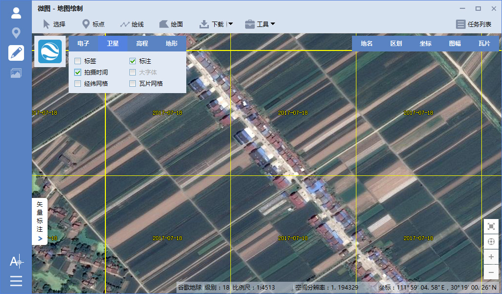
勾选“拍摄时间”可以查看谷歌地球影像的拍摄日期,如下图所示。
7.高清历史影像下载
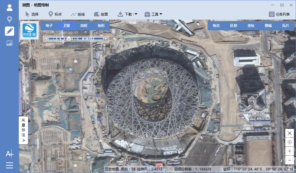
选择“历史影像”,可以查看谷歌地球的历史影像地图,2007年2月17日世界瞩目的鸟巢建设情况历史影像如下图所示。
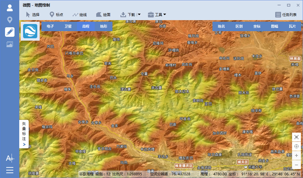
8.原始高程数据下载
可在线查看高程渲染图,下载的高程可在专业软件中打开生成专业渲染图、提取等高线或作波度分析等,效果如下图所示。
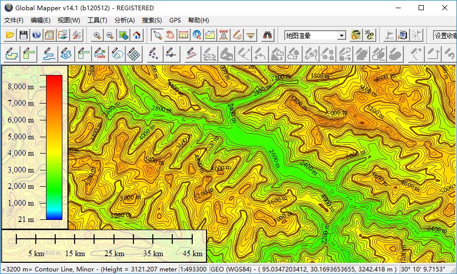
9.高程等高线的提取
下载的高程数据可在GlobalMapper中打开后提取生成等高线,并可以将生成的等高线导出为SHP、DXF、TAB或KML等几十种矢量数据格式,生成的等高线效果如下图所示。
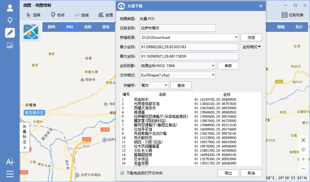
10.矢量兴趣点(POI)下载
可下载矢量兴趣点(POI)数据,如宾馆饭店、餐饮美食、公共设施、行政地标、加油站、交通运输站、金融证券机构、科研教育机构、旅游景点、企事业单位、地名、商厦超市、写字楼、休闲娱乐、邮政电信、ATM机网点和基站站点等。
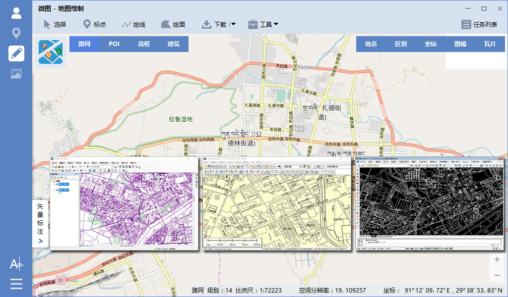
11.全球矢量路网下载
可以下载全球矢量路网,并可以将数据导出为SHP、DXF、TAB或KML等矢量文件,如下图所示。
12.全国建筑轮廓下载
可以下载全国大中型城市的矢量建筑数据,并可以将数据导出为SHP、DXF、TAB或KML等矢量文件,如下图所示。

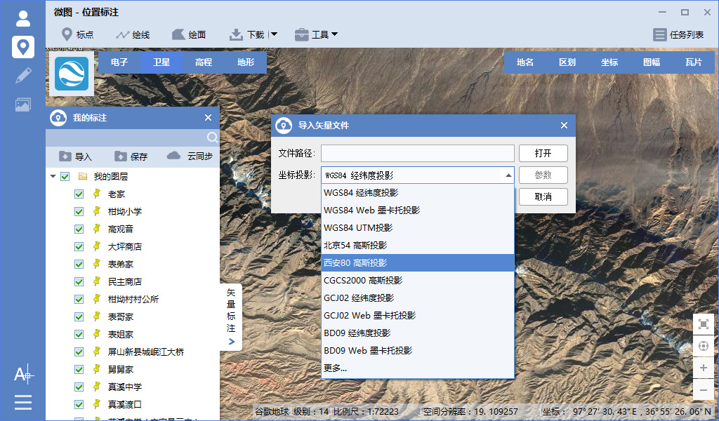
13.影像矢量投影转换
支持导入和导出多种投影的矢量数据,包括WGS84经纬度投影、WGS84 Web墨卡托投影、北京54高斯投影、西安80高斯投影、CGCS2000高斯投影、GCJ02经纬度投影、GCJ02 Web墨卡托投影、BD09经纬度投影和BD09 Web墨卡托投影等。
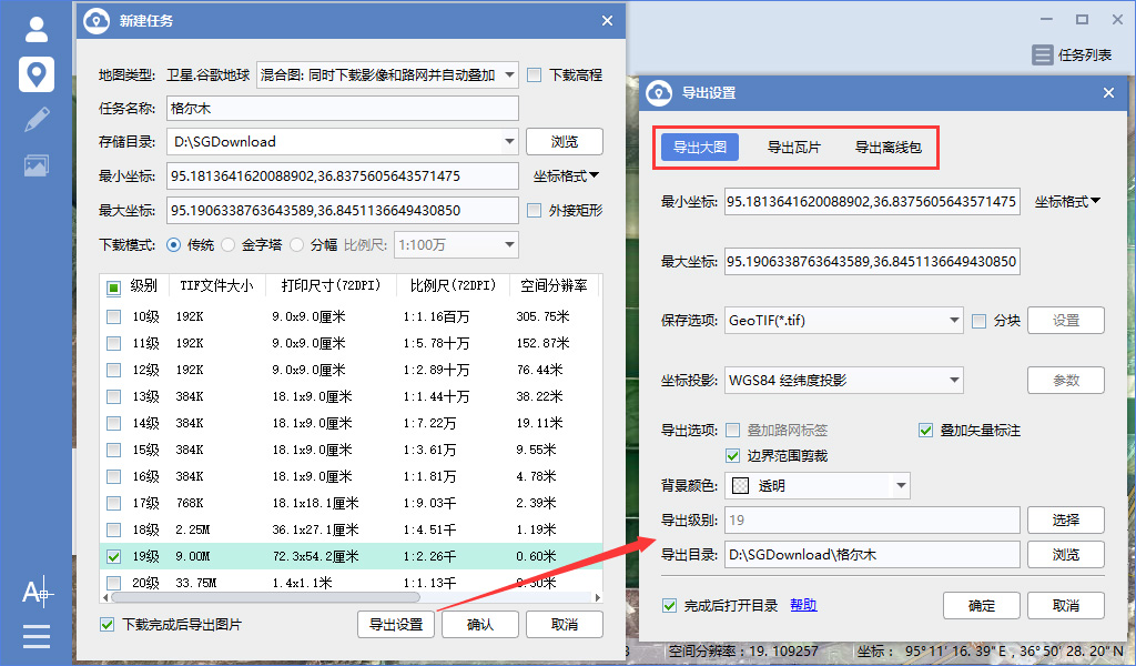
14.导出大图瓦片和离线包
下载的卫星影像或栅格电子地图可以导出TIF\PNG\JPG\BMP大图并进行投影转换,也可以导出原始TMS瓦片、WorldWind瓦片、水经注瓦片和无所不能的自定义瓦片,还可以导出MBTile离线包、OruxMaps离线包、GeoPackage离线包和SQLiteDB离线包等。
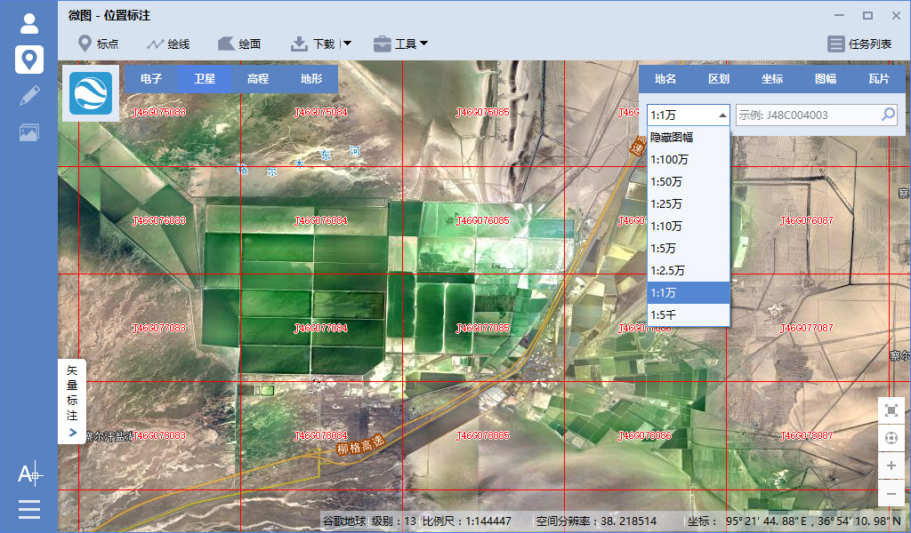
15.国家分幅图幅下载
支持1:100万、1:50万、1:25万、1:10万、1:5万、1:2.5万、1:1万和1:5千等国家标准分幅图幅下载,如下图所示。
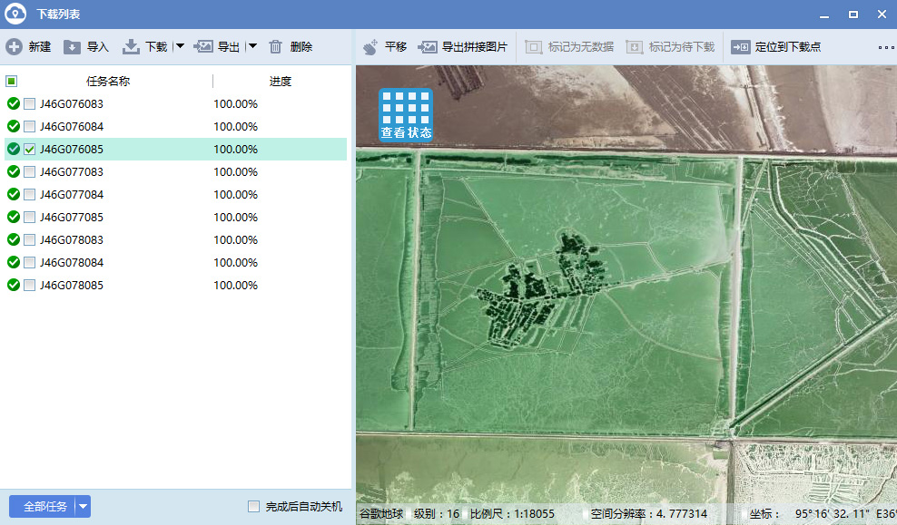
16.即时查看下载结果
下载过程中支持即时查看下载结果和下载状态,并支持批量修改导出任务参数和批量导出任务,如下图所示。
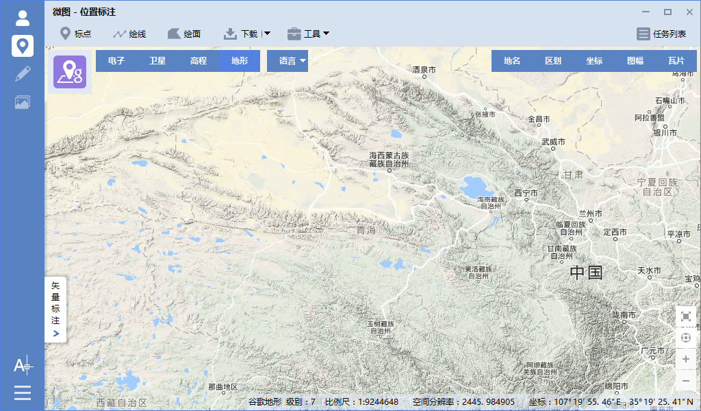
17.地形地貌渲染图下载
支持下载地形地貌渲染图,如下图所示。
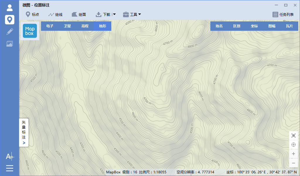
18.10米等高线栅格图下载
支持下载10米等高距的栅格图,如下图所示。
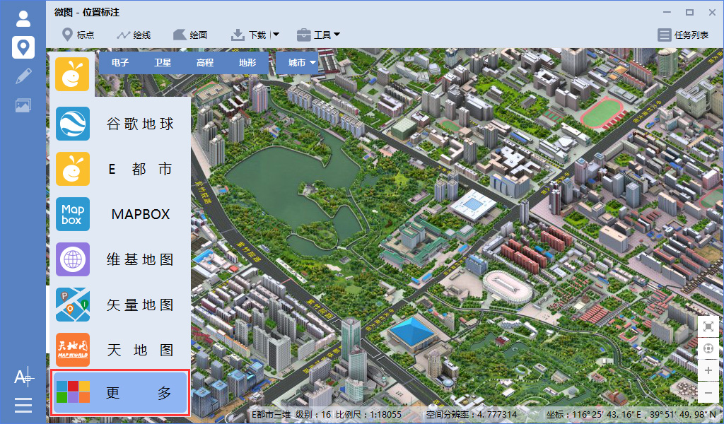
19.丰富多种的地图资源
支持多种地图类型,并可以自定义URL下载地址下载任何以瓦片方式发布的地图数据,如下图所示。
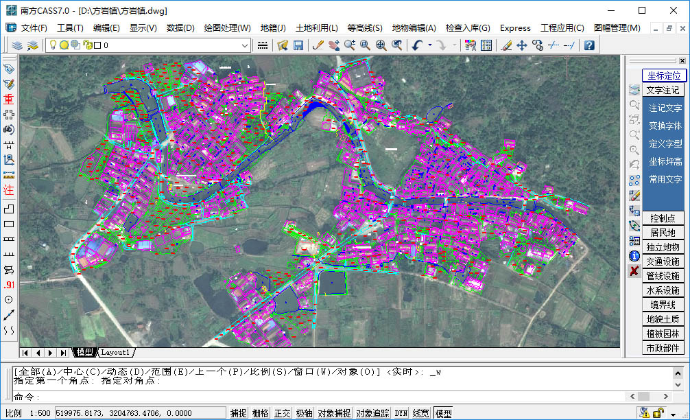
20.矢量数据与影像在CAD中完美叠加
下载的影像数据经过投影转换之后,可以与西安80的矢量数据完美叠加,效果如下图所示。
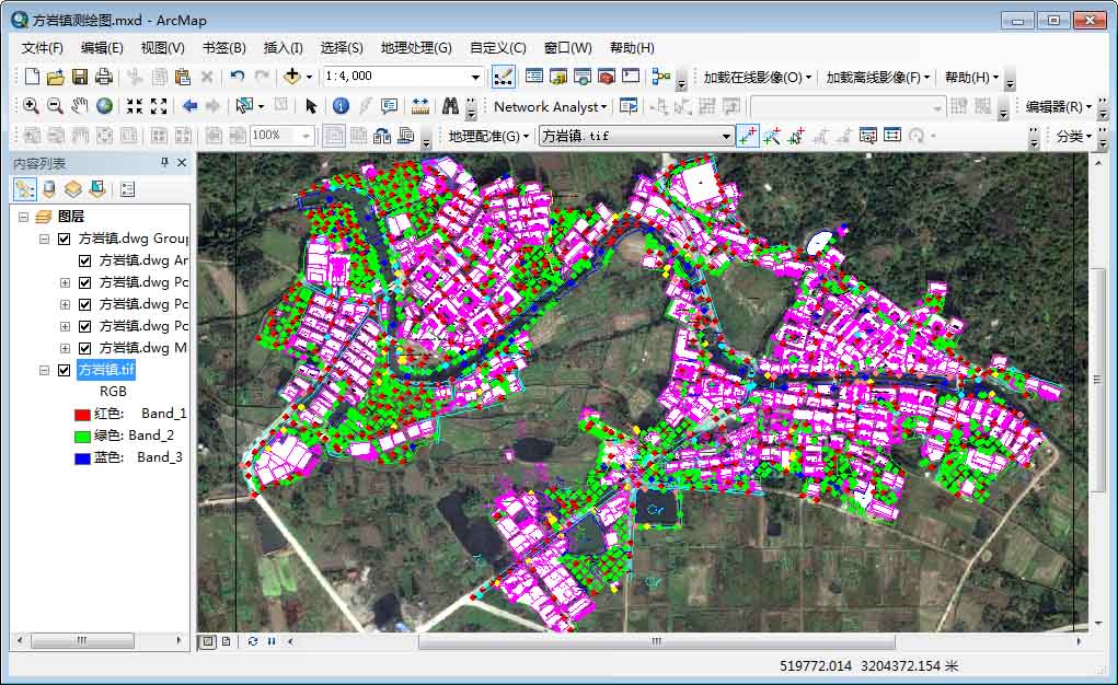
21.矢量数据与影像在ArcMap中完美叠加
下载的影像数据经过投影转换之后,可以与北京54的矢量数据完美叠加,效果如下图所示。
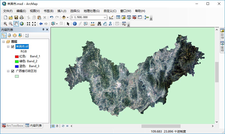
22.支持影像数据裁剪和背景透明
可以按行政区划下载卫星影像,并按行政区划进行多边形裁剪并让背景透明,效果如下图所示。
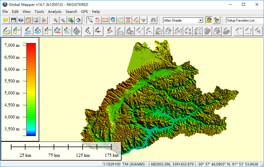
23.支持高程数据裁剪和背景透明
可以按行政区划下载高程数据,并按行政区划进行多边形裁剪并让背景透明,效果如下图所示。
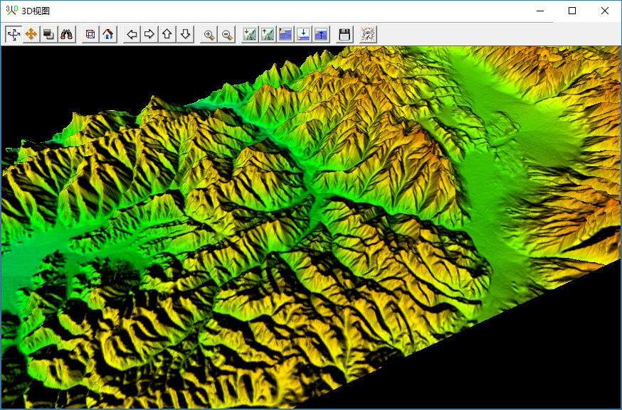
24. The downloaded elevation data can display three-dimensional topography
The downloaded elevation data can be directly generated in GlobalMapper to generate three-dimensional topography, the effect is shown in the figure below.
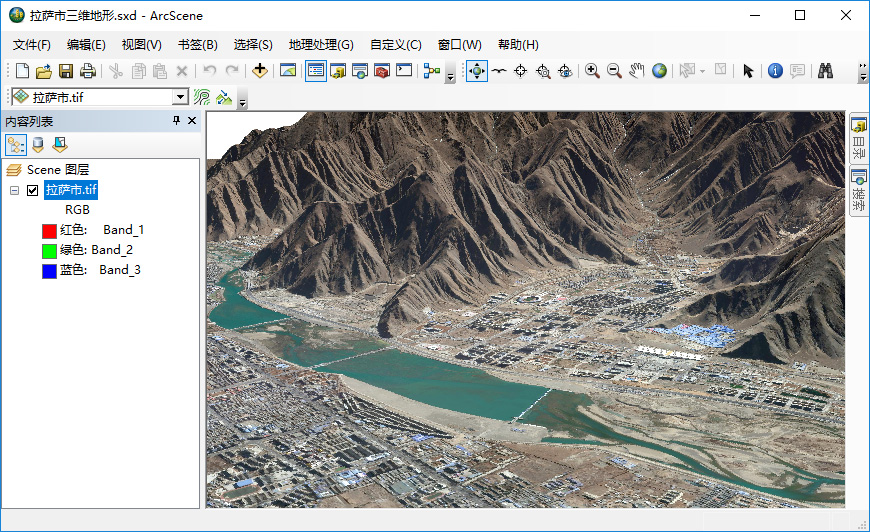
25. The downloaded image data and elevation can build a 3D scene
After downloading satellite imagery and elevation data, you can build an offline 3D scene in ArcScene, as shown in the following figure.
As a brief function description, the above is just a list of some of the features in "Shuijing Micro Map". For more detailed functions, please visit the official website of Shuijingzhu .