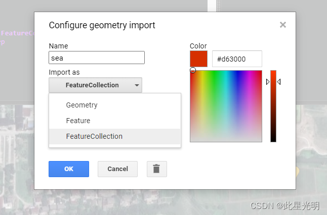
很多时候我们无法正常使用EE中的函数,其实我们只要一个个函数去实验和练习,就很快能掌握每一个函数,本次我们来详细看看flatten函数的使用。这次我们假设有几个土地分类的训练样本分别产看我们使用flatten和不适用flatten的结果进行对比,但是我们这里要注意,如果直接使用GEE中的画图工具进行选点的时候,默认给的属性是geometry,但我们其实需要的每一类都是一个矢量集合,所以我们要将属性设定为矢量集合featurecollection。
函数:
flatten()
Flattens collections of collections.
Arguments:
this:collection (FeatureCollection):
The input collection of collections.
Returns: FeatureCollection
展平()
展平集合的集合。
参数:
这个:集合(FeatureCollection):
集合的输入集合。
返回:FeatureCollection
代码:
var sea = /* color: #d63000 */ee.Fea