The yearning and curiosity about the deep space are the romance deeply rooted in the genes of the Chinese nation. A poet of the Song Dynasty once asked: Who supports the Tai family, the mountains, rivers and the universe?
In the digital age, the answer to this question should be storage.
We once interviewed a doctor from the Chinese Academy of Sciences who specializes in deep learning and planetary remote sensing image processing. The person mentioned that in traditional space science projects, whether it is the moon, Mars or deep space exploration, all images and data collected must be transmitted first. Return to the ground and deal with it one by one.
Such large-scale high-definition remote sensing image data may even need to be stored for decades for scientific research. And this is just one of the application directions of remote sensing. Today, remote sensing satellites are used in agriculture, forestry, oceans, land, environmental protection, meteorology and other fields to provide necessary data support for the construction of Digital China.
Using data to understand mountains and rivers requires a powerful storage base as a support.
Taking farmland as an example, the data from remote sensing satellites must be accurate to the image of each wheat plant. The storage resources required are almost astronomical. Facing the test of this era, the dual strengths of China's remote sensing industry and storage industry have indeed fulfilled their responsibilities.
Changguang Satellite is my country's first commercial remote sensing satellite company, integrating R&D, manufacturing, operation management and remote sensing information services. In the fully competitive market of commercial remote sensing, Sugon Storage has provided storage services for Changguang satellites for many years, providing a total of more than 20PB of storage space, supporting full life cycle management from data collection, application to archiving.
The story of their hand in hand may satisfy everyone's curiosity: How do satellite remote sensing and storage come together to build a digital China?
Storage revolution
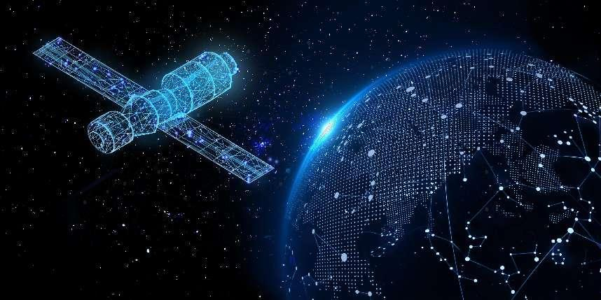
Answer the call from deep within the galaxy
To briefly introduce, remote sensing data mainly comes from satellites of the outer space remote sensing platform. It is designed according to actual needs and returns the data required by various industries.
For example, remote sensing data from meteorological satellites can draw weather maps, help monitor typhoons, hurricanes, cloud top temperatures and other conditions, and provide timely warnings for extreme weather. It is an indispensable type of data in navigation, fishing, crops, and urban life. The earth's surface image data collected by the Land Resources Satellite will be used for land census, resource exploration, project site selection, etc. The navigation maps you and I use every day also have a share of its contribution.
In the digital age, the remote sensing industry has also kept pace with the times and issued a call to embrace new technologies. Combined with AI technologies such as deep learning and large models, it has produced a large number of cutting-edge exploration applications and also posed challenges to storage infrastructure. The specific requirements are Let’s start with the “changes in heaven and earth” in remote sensing.
First, the change of heaven.
In the air, there are more and more types of satellite payload data, which puts forward new requirements for storage.
For example, there are many types of remote sensing data, including tens of gigabytes of high-resolution imaging data, 100M of medium-speed payload data, and 1M of satellite platform health management data. These heterogeneous data require different storage capabilities and are extremely complex. Earth adds to the complexity and cost of storage.
Another example is the enhanced real-time nature of remote sensing data. Taking meteorological satellites as an example, everyone has higher and higher requirements for weather forecast accuracy, which has increased from days to hours. To meet the needs of real-time information collection and processing, data must be obtained more quickly and conveniently, which puts forward more stringent requirements for storage.
In addition, satellite payload information is directly related to the security of basic national information. The core storage technology and software and hardware products must be independently controllable across the entire stack in order to provide solid support for the development of the remote sensing industry.
To sum up, the remote sensing industry has an increasingly urgent need for high-performance, cost-effective and secure space-based storage.
Next, we turn our attention to the ground and talk about the "changes in the ground" of remote sensing data.
The raw data collected by remote sensing satellites must be downloaded to the ground station system to support various remote sensing applications. Among them, the storage system is the core infrastructure of the foundation part and the ultimate carrier of remote sensing data.
In recent years, ground-based storage in the field of remote sensing has also undergone a series of changes:
1. Save. The new generation of information technology with artificial intelligence, big data, IoT, etc. as its core has been increasingly widely used in the digital economy, bringing about a massive data blowout. For example, for the popular AI large models, training large AI remote sensing models requires the use of ultra-large-scale, multi-modal remote sensing data for training. Ground storage must have massive data storage and archiving capabilities to provide support for subsequent businesses.

2. Get it quickly. Remote sensing data has begun to be applied in many industries. For example, in smart agriculture, remote sensing technology is used to provide navigation for agricultural drones and unmanned vehicles. More and more businesses are being developed, which require real-time computing, high concurrency, efficient and stable expansion, Mixed load and other capabilities can support as many concurrent applications as possible and fully unleash the value of remote sensing data in the digital economy.
The China National Space Administration pointed out in the "Key Development Plan for the '14th Five-Year Plan' and the Future Period" that it is necessary to continuously enhance satellite application service capabilities to support economic and social development.
It is certain that during the 14th Five-Year Plan period, commercial remote sensing will usher in a golden development period and play an indispensable role in the construction of Digital China. At this time, commercial remote sensing urgently needs a powerful storage partner. As the "national team", Shuguang Storage took the lead in shouldering the responsibility.
Dawn is the stage
Supporting the evolution of the remote sensing industry
Technological innovation is the core driving force for the development of the remote sensing industry. Between commercial remote sensing and digital mountains and rivers, Sugon Storage relies on its technology accumulation and application understanding to use solid steps to support the smooth implementation of commercial remote sensing in thousands of industries.
The first step: basic performance to make remote sensing data more usable.
Low storage and fast storage are the basic requirements for remote sensing data storage. Through unified memory management, dedicated storage thread cores, refined disk management, and in-depth optimization of data IO paths, Sugon Storage helps Changguang Satellite achieve a bandwidth level of 10GB/s for client single-stream writing, ensuring that data can be delivered when the satellite is in transit. Fast writing allows users to obtain remote sensing data more quickly and conveniently.
The second step: fine control to make remote sensing services more useful.
Using it well and quickly is a prerequisite for remote sensing data to further develop its value. Sugon Storage has developed refined permission management functions tailored for Changguang satellites in all aspects of data processing and distribution. Whether on the Windows or Linux client, operations such as reading, writing, deletion, and permission modification can be precisely controlled. And it can achieve millisecond-level response to million-level directory permission settings, greatly improving the efficiency of data processing and data management. It lays a foundation for in-depth analysis of remote sensing data, value mining and the integration of other data sources, allowing remote sensing data application services to play a greater role in the process of intelligence and digitization.
The third step: sustainable development, allowing the remote sensing industry to achieve steady and long-term development.
As mentioned earlier, remote sensing image data has complex categories and diverse uses. Therefore, hierarchical storage is a common storage strategy. Different storage components for cold data, warm data, and hot data require "strong operation and maintenance" and will bring greater costs. Therefore, Sugon Storage's automatic grading allows remote sensing data to be stored in a lower-cost, more efficient, and more sustainable way.
Specifically, hierarchical storage provides online storage for hot data, such as commonly used, latest, and data that needs to be accessed quickly. Some warm data that is stored for a long time and may need to be accessed uses near-line storage. Cold data that needs to be saved for a long time but is not commonly used is stored offline, and the data is extracted through robots or manual operations.
Sugon Storage's automatic hierarchical storage strategy can make full use of storage resources, ensure the automatic flow of data in hot, warm, and cold storage pools, greatly improve the efficiency of data access, and comprehensively reduce storage costs, providing safe, reliable, green, energy-saving, and Low-cost storage services.
It can be seen from this that between the remote sensing market and industry applications, from the depths of the galaxy to the fireworks world, Sugon Storage has built usable, easy-to-use, and sustainable steps, and ultimately connected the two together to promote the development of the remote sensing industry. Greater social and economic benefits.
In the trend of using data to empower intelligence, all industries need to fully integrate data resources and maximize the value of storage infrastructure. From this perspective, in the process of building Digital China, remote sensing data has unlimited potential, and the remote sensing industry has great potential. However, before remote sensing lights up the digital landscape, the storage base must be more solid and powerful.
Star shines in China and stores in the world. When we step on the steps of Dawn Storage and carve the footprints of "China's scientific and technological independence" in deep space and on the earth, we will be closer to the golden age of the digital economy.