
Two days ago I shared the Star Map Earth Data Cloud online map: Missing image source? Check out this useful and stunning online satellite map! Orvi and GIS software can be added. However, the only drawback is that they do not currently support ArcGIS (currently in production and will be announced later). So today we will summarize loading various online maps in ArcGIS.
1. Map plug-in
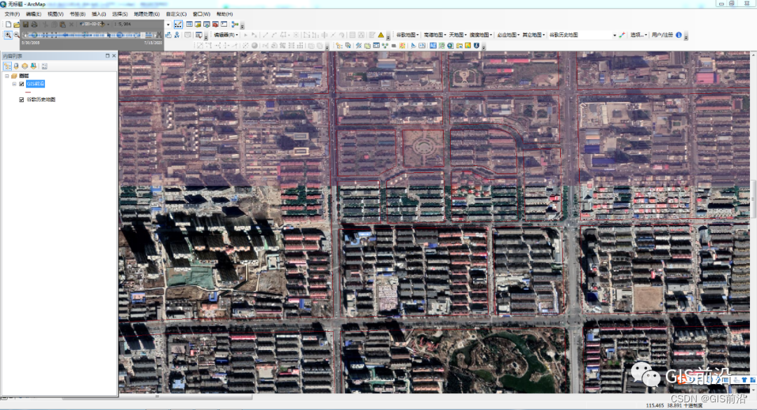
If you want to load various online maps, the most convenient thing is the map plug-in, which can be used in one step. There are also many related plug-ins on the Internet. Among these plug-ins, the official plug-ins of Datahe are more useful.
The map data is relatively rich. For a detailed introduction, you can read this article: Can Google’s unoffset satellite images be loaded into ArcGIS? There are actually historical images? !
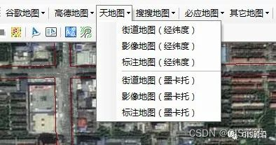
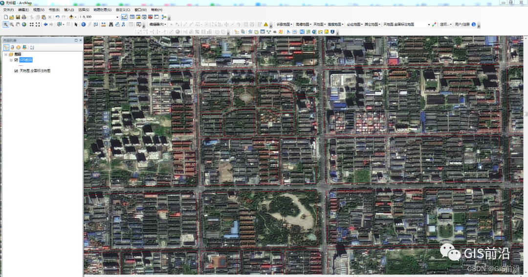
Sky map (latitude and longitude, Mercator)
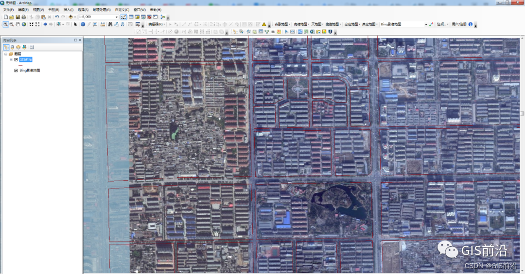
Bing Maps
ESRIWorldImagery (unbiased)

OSM
2. Load the OGC service
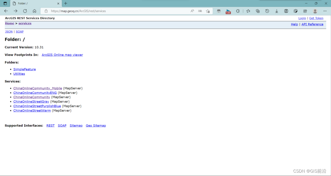
- Some service websites
https://map.geoq.cn/ArcGIS/rest/services
http://services.arcgisonline.com/ArcGIS/rest/services
https://sampleserver6.arcgisonline.com/arcgis/rest/services
- Add OGC service to ArcMAP
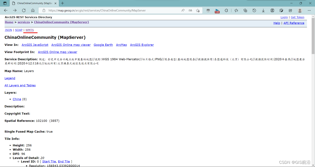
Open the URL with a browser and select the desired map server.
Click WMTS in the upper left corner to jump to a page full of code and copy its URL.
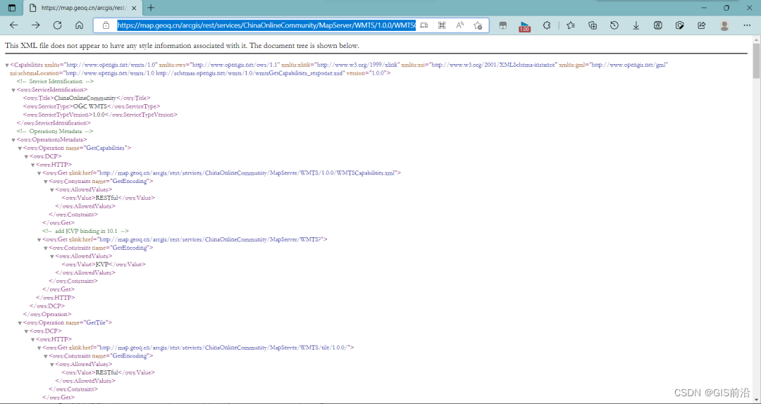
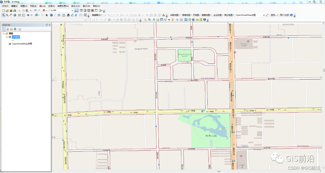
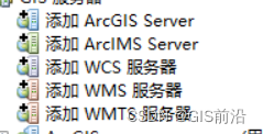
Open ArcMAP, open the directory in the software, double-click the GIS server -> Add WMTS server.
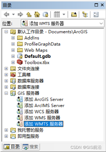
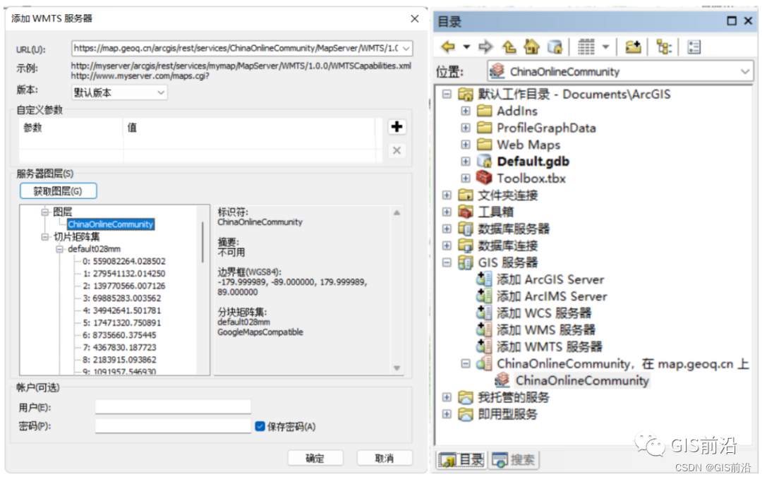
Copy the URL into the right column of URL, click Get Layer, and click OK to see the online map layer in the directory.
3. Add Tiantu service
- Tiantu-Map API
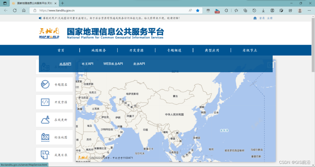
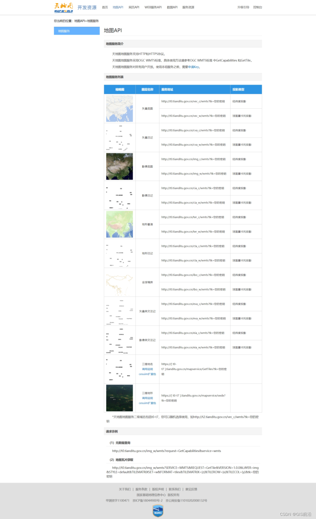
Open the official website of Tiantu and select Development Resources -> Map API.
In the newly popped-up webpage, you can see the addresses of many online services, but these addresses are followed by the words [your key], which means that you need certain permissions to use these online services. We only You need to click Apply for Key and follow the process to apply.
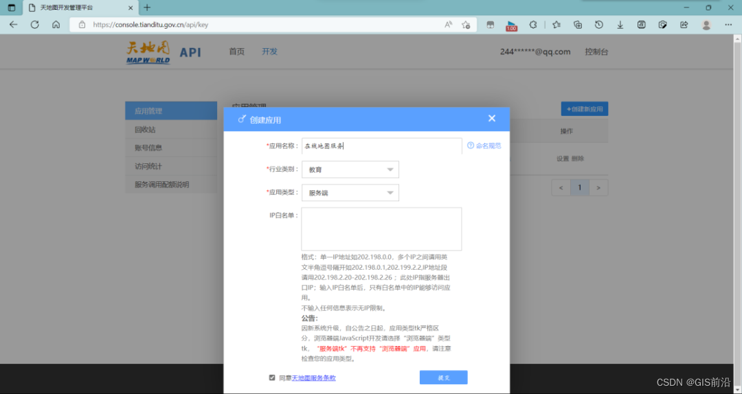
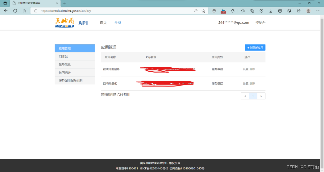
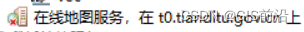
You can also click on the console here (first of all, you must have your own registered account. Generally, we just look at the data in the GIS software and apply for personal registration), click [Create New Application], fill in the form according to personal circumstances, and click Submit. The key is available.
- ArcMAP add layer
Copy the key and the required layer service address, double-click to add the WMTS server as before, paste the layer's service address to the right of the URL, paste the key to the value of the parameter, click to get the layer, and click OK to You can see the online map layer in the directory. In addition, the 10.2 version of ArcMAP does not have a custom parameter column, so just write the key directly after the layer's service address.
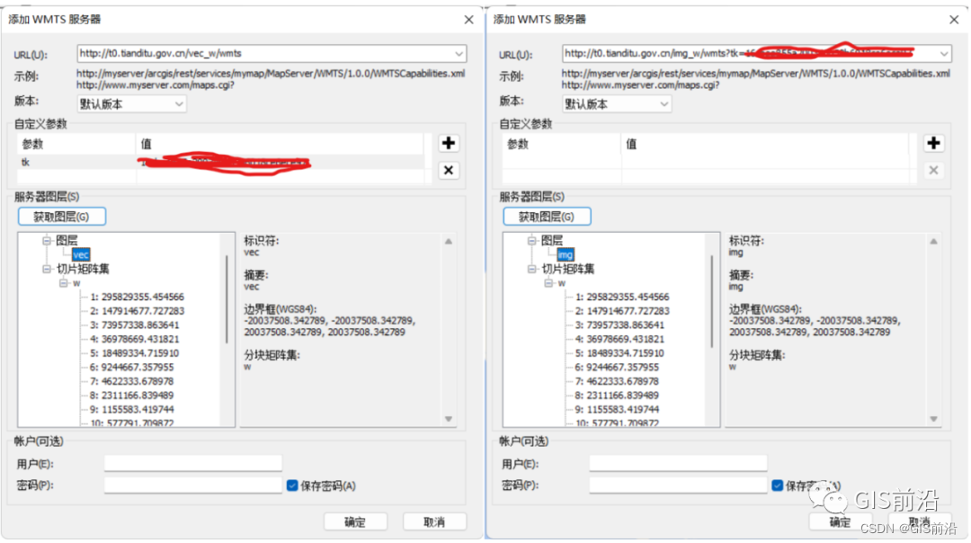
In addition, there will be such a situation, just double-click.
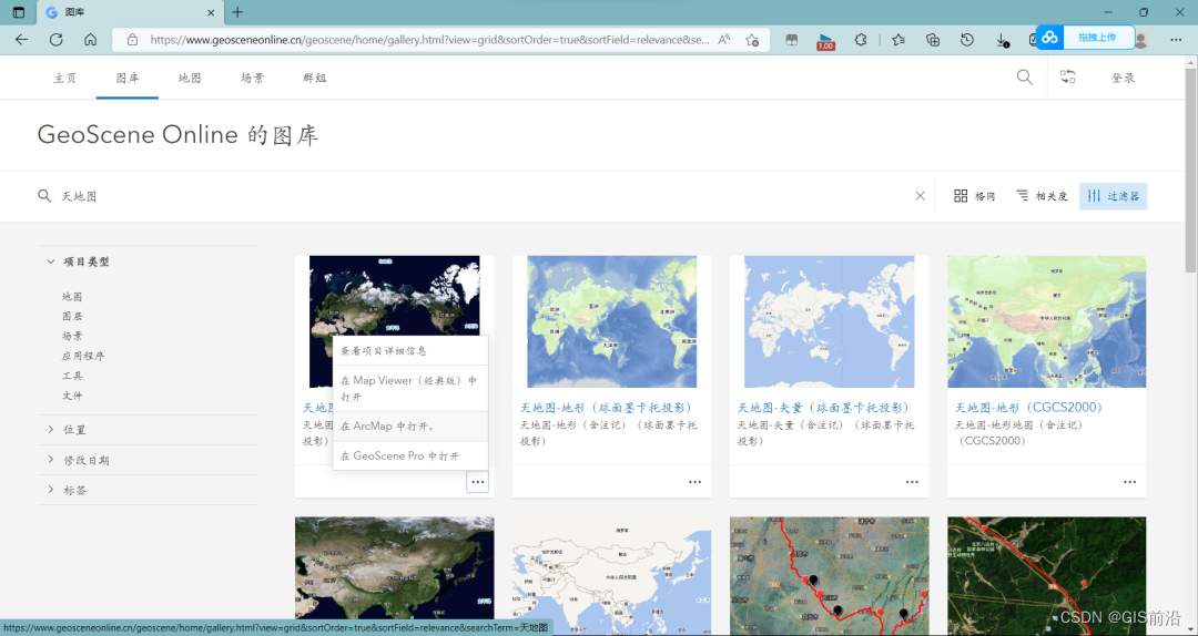
- GeoScene Online
https://www.geosceneonline.cn/geoscene/home/index.html
Open the URL with a browser, select the gallery, enter Sky Map in the search box, select the required layer, click... in the lower right corner, and choose to open in ArcMAP.
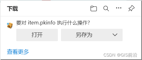
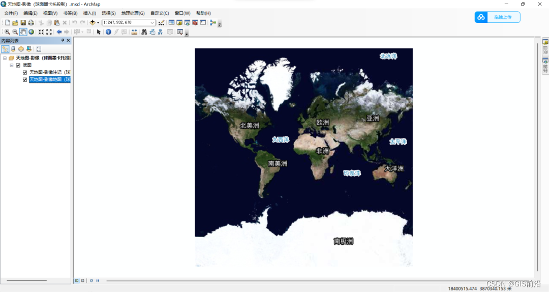
A download box will pop up on the web page. After the download is completed, double-click to open it. By default, ArcMap will be opened and a blank map will be created, and the sky map will be loaded as a base map.
In addition, there are other styles of online maps on the website. Friends who are grateful can explore them on their own.
4. Others
- Add WMTS server
URL:http://xdc.at/map/wmts/
- Add ArcGIS Server
Server URL: http://map.geoq.cn/ArcGIS/rest/services